Director's Report
Welcome to the Brandywine Conservancy’s autumn edition of Environmental Currents!
Like so many others, autumn is my favorite season. With a wet summer drawing to a close I am hopeful for some drier fall weather and the beautiful color that comes with the changing foliage. Meanwhile, the weather report this morning looks perfect for our third annual Bike the Brandywine which takes place this Saturday, September 22. I will be there to cheer along the cyclists who get to ride through some of the most spectacular scenery in this region—land that is part of the Brandywine Creek Greenway and highlights many of the farms and vistas that the Conservancy has helped protect over the years. I hope you will join me if you are a cyclist.
I am honored to work alongside the staff at the Brandywine Conservancy and our many partners in conservation. The understanding of conservation has many faces and is made up of diverse acts, small and large. From planting a tree alongside a stream to conserving thousands of acres of land; from coordinating a conservation conference for hundreds to helping a few children place live trout in a stream. Success can only be achieved in acts, small and large alike.
We at the Brandywine Conservancy are as diverse in our activities and expertise as the natural world and, like nature, comprised of various parts that—when considered together—make up a magnificent whole. In this edition, you will see that diversity and read about so many projects and programs that simply do not seem to have connection to the next—but they do indeed. The connection is our devotion to mission and the places where that mission unfolds.
With so much going on—including the immense community engagement and enthusiasm to protect this place we call home—it’s an exciting reawakening and reengagement for the Conservancy.
As always, thank you for supporting us for more than 50 years. May we continue on, hand in hand, toward our shared visions and mission of protecting these precious lands and waters and engaging with the people and communities who take comfort and inspiration from them.
Ellen
Ellen M. Ferretti
Director, Brandywine Conservancy
P.s. Interested in planning and conservation assistance? Ask us about our new brochure!
Brandywine Conservancy Commemorates its Preservation of Key Battle of Brandywine Site
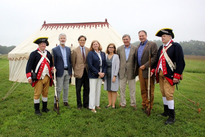
On September 11, 2018—the 241st anniversary of the legendary American Revolutionary War Battle of Brandywine—the Brandywine Conservancy commemorated its acquisition of a key piece of land within the heart of the historic battlefield. Complete with the Museum of the American Revolution’s replica of George Washington’s tent, one of the Commander-in-Chief’s guards along with members of the 1st Delaware Regiment, and the occasional volley of musket fire, the dedication ceremony celebrated the purchase of a 13-acre parcel located on Birmingham Hill—the epicenter of the battlefield—which merges with an adjacent 100 acres previously acquired by the Conservancy in 2007. This acquisition completes the organization’s remarkable 25-year endeavor to preserve over 500 contiguous acres where the fiercest fighting transpired during the Battle of Brandywine.
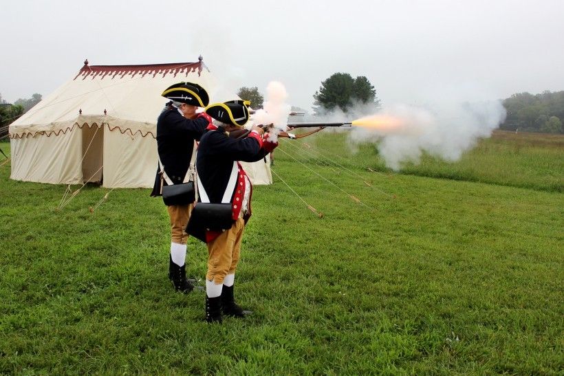
Standing on top of Birmingham Hill, reenactors from the 1st Delaware Regiment fire off a few rounds from their muskets during the Brandywine Conservancy’s dedication ceremony celebrating its acquistion of a key piece of land located in the heart of the historic Brandywine Battlefield. A replica of George Washington’s tent sits in the background, courtesy of the Museum of the American Revolution.
“Today, we mark the acquisition of the final piece of a decades long struggle. It is with profound excitement for the future of this land that we will soon undertake a master planning process to really explore how we can best activate and interpret this site,” said Ellen Ferretti, Director of the Brandywine Conservancy. “We look forward to working with all levels of government, with the community, our neighbors and area experts to create a plan that will pay homage to the significant events that took place here and engage future generations in its preservation.” David Shields, Associate Director of the Brandywine Conservancy, has been at the forefront of the effort to save the Battlefield and this land from development. “Piece by piece, and with the strong support of our major funders, our goal to protect the historic properties in the Battlefield’s Meetinghouse Road Corridor is complete,” commented Shields. “This is a personally gratifying moment for me as I’ve been working on this project since its inception.”
During the ceremony, Pennsylvania Senator Tom Killion and Representative Carolyn Comitta spoke on the importance of the preservation of our nation’s history. “Birmingham Hill is an incredibly significant Revolutionary War site for our country,” noted Senator Killion. “The Brandywine Conservancy has worked for decades to save hundreds of acres of the Brandywine Battlefield. We are immensely grateful for their efforts in protecting our land and preserving America’s history.”
“I have long admired the extraordinary work of the Brandywine Conservancy and am pleased to offer my congratulations and support for this project,” said Representative Comitta. “I believe this purchase will allow for the permanent preservation of a vital part of our collective history and an important national treasure.”
Beginning in the mid-1990s, the Brandywine Conservancy and a consortium of local preservation groups, citizens, and federal, state, county and local government officials formed the Brandywine Battlefield Task Force. In addition to interpretation and education about the battle, the Task Force’s mission was to implement public and private partnerships to preserve lands within the Brandywine Battlefield National Historic Landmark. This was the beginning of a concerted effort by the Conservancy to preserve the remaining undeveloped historic sites where the heaviest battle action occurred. Over the next 25 years, nearly $18 million was raised to purchase land outright or buy conservation easements resulting in the permanent protection of 500 acres of the battlefield. Chester County, the Commonwealth of Pennsylvania and the National Park Service were key partners in the project, along with Natural Lands. Securing this last parcel on Birmingham Hill brings fulfillment to decades of work to preserve the area as a contiguous whole and prevent development in the heart of one of the nation’s most important historic battlefields.
The final acquisition of the Birmingham Hill property was made possible by generous support and contributions by many dedicated supporters, including the National Park Service American Battlefield Protection Program, Chester County, the Longwood Foundation, the late Mr. H. F. Lenfest and his wife, Marguerite, the McLean Contributionship, the American Battlefield Trust, the Army Corps of Engineers, the Crestlea Foundation, the William P. Worth Trust, Mr. and Mrs. William P. Worth, III, Mr. Peter Rogers, and Ms. Dianne Bricker.
In protecting this piece of our national heritage for future generations, the Brandywine Conservancy looks forward to its next chapter planning the long-term use and management of the Birmingham Hill property. Conservancy staff will undertake a master planning process that is expected to take a year to complete. The immediate goals are to preserve the property’s historic integrity and conserve its existing natural resources, while working alongside qualified partners. Eventually the Conservancy hopes to open the property for public visitation—respectful of the site’s historic value—with opportunities for public education and interpretation programs.
The Battle of the Brandywine took place on September 11, 1777 on roughly 10-square miles along the Brandywine River in Chester and Delaware Counties. Approximately 26,000 soldiers were actively engaged at Brandywine—considered one of the largest battles of the American Revolution in terms of combatants. Both British and American forces suffered heavy losses that day, and while the latter eventually retreated, a new respect was gained for the Americans’ demonstrated resolve and discipline in battle.
In 1961, the Secretary of the Interior designated the Brandywine Battlefield as a National Historic Landmark—one of oldest of 169 Landmarks in Pennsylvania and 2,596 Landmarks nationally. It was not until May 1977 that the National Park Service certified the Landmark’s boundaries. In 1997, the Brandywine Battlefield National Historic Landmark was designated as the first official Commonwealth Treasure by the Pennsylvania Historical and Museum Commission in recognition of “the remarkable community dedication to the preservation of the historic integrity of the Brandywine region as a landmark of tremendous significance in the shaping of our Commonwealth and nation.”
Land within the Brandywine Battlefield National Historic Landmark is held principally in private ownership involving thousands of individual parcels ranging from less than an acre to over 200 acres in size. Since the mid-1980s, the entire Landmark has been severely threatened with irrevocable loss from suburban development. For years, Battlefield lands have been identified as threatened and endangered by both the Commonwealth of Pennsylvania and the National Park Service. Today, over 52% (3,350 acres) of the land within the Landmark are permanently protected.
Upcoming Calendar of Events
Fern ID Walk in the Laurels Preserve
Saturday, September 15
Fall Garden Walk
Wednesday, September 19
Bike the Brandywine
Saturday, September 22
Palette to Palate
Saturday, September 29
Fall Birding at Waterloo Mills Preserve
Wednesday, October 3
A Walk in Penn's Woods
Sunday, October 7
Laurels History Hike at the Laurels Preserve
Sunday, October 14
Laurels Preserve Trails Loop Hike
Sunday, October 21
Trail Stewardship Workshops
Thursday, October 25 & Friday, October 26
Winter Tree ID Walk at the Laurels Preserve
Saturday, November 17
From Collaborative Planning to Complementary Zoning
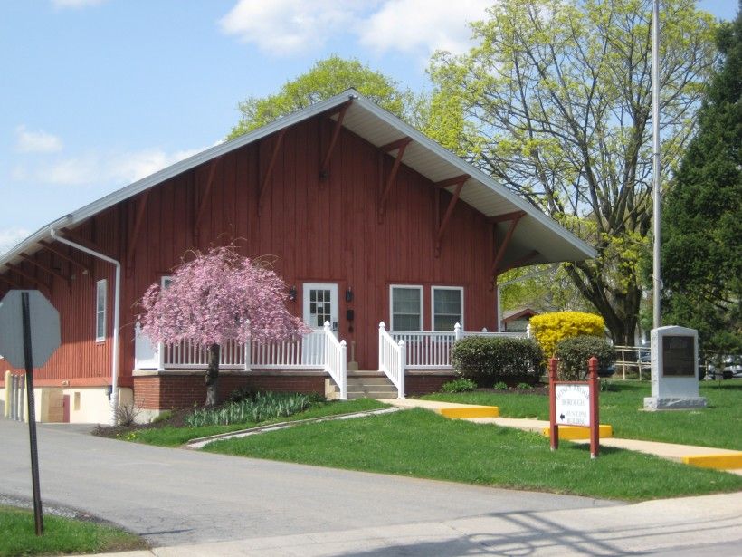
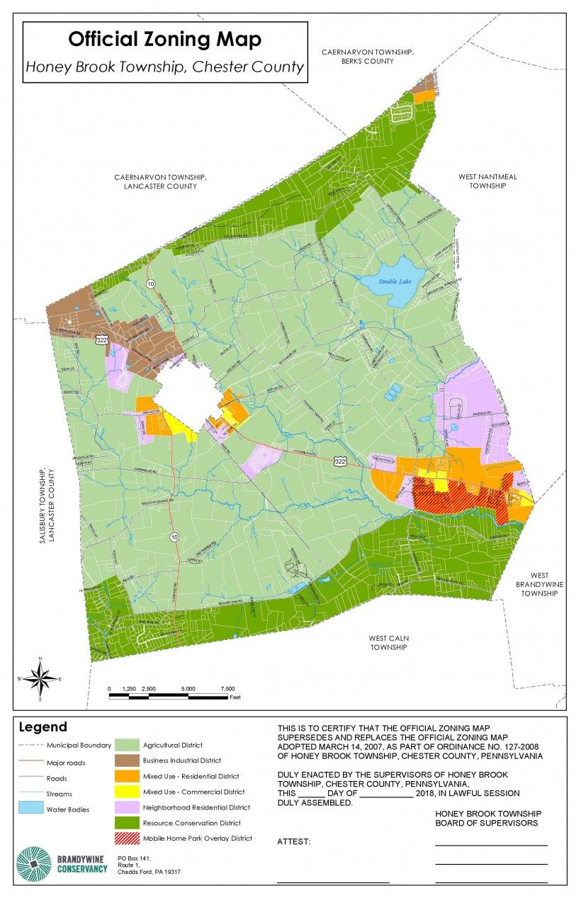
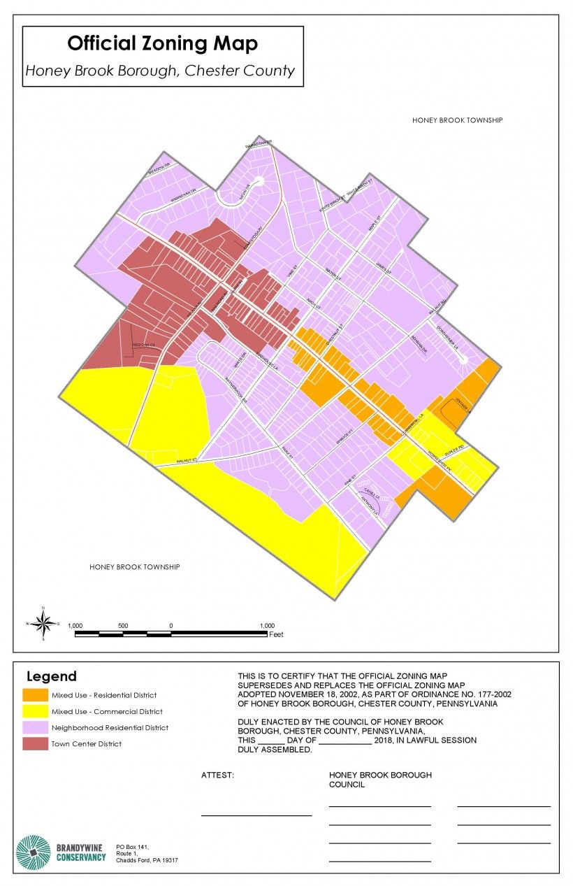
In 2015 the Brandywine Conservancy’s Municipal Assistance Program (MAP) facilitated a cooperative joint planning effort between Honey Brook Township and Honey Brook Borough—located at the headwaters of the Brandywine—to shape future land use on a regional scale. This effort resulted in their first major achievement: adoption of the 2015 Honey Brook Township and Borough Multi-Municipal Comprehensive Plan. Each municipality found that by planning together, the Township could better achieve its goal of retaining its rural character and agricultural economy, while the Borough could better achieve its goal of increased economic and social vitality as one of the County’s northernmost historic towns.
Now, three years after plan adoption, these two municipalities are reaching their second major achievement: new zoning ordinances that are consistent with the 2015 comprehensive plan. Both new ordinances were drafted by the Conservancy’s MAP staff, working closely with the same multi-municipal task force that produced the previous comprehensive plan. A second Chester County Vision Partnership Program planning grant covered much of the Conservancy’s staff time, and enabled helpful assistance by County Planning Commission staff. Adoption hearings are scheduled for mid-September of this year.
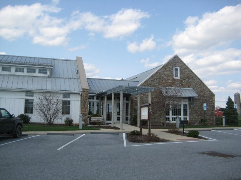
The new ordinance text and zoning map for each municipality are based on several recommendations of the recently adopted comprehensive plan, including the Future Land Use Plan and map, natural and cultural resource related recommendations, and housing recommendations. Other new or revised ordinance provisions addressed changes or updates necessitated by state planning law. Unique to the Honey Brook Township and Borough zoning ordinance update efforts, however, were the following multi-municipal task force and consultant actions:
-
Forming an Intergovernmental Cooperative Implementation Agreement;
-
Simultaneously drafting the two new zoning ordinances (text and maps);
-
Developing individual, but complementary, ordinances rather than a joint zoning ordinance;
-
Excluding some uses from one ordinance when included in the other;
-
Enabling through zoning the Transfer of Development Rights (TDRs) from the Township to the Borough for use by landowners and developers for future development.
1. The formation of the Intergovernmental Cooperative Implementation Agreement
The Intergovernmental Cooperative Implementation Agreement executed by Honey Brook Borough and Township was modeled after a similar one developed by the Chester County Planning Commission for the Oxford Region. The Honey Brook agreement establishes a process for the two municipalities to follow when implementing their multi-municipal comprehensive plan through ordinance amendments, review of developments of regional significance and impact, and amendments to the plan. The agreement also establishes a process for the two municipalities when considering actions that may not be generally consistent with their comprehensive plan, and a process for dispute resolution.
MAP staff modified the County sample for the two Honey Brooks by adding a process for joint review of other developments in close proximity (to either the Township or Borough), and also by establishing a multi-municipal planning commission comprised of Borough and Township planning commission members. This multi-municipal planning commission will not replace the Township’s or Borough’s planning commission, nor substitute for their respective duties and powers, but will meet as necessary to review and make recommendations to the Township Board of Supervisors and/or Borough Council on proposed zoning or SALDO ordinance amendments; developments of regional significance and impact; other developments in close proximity; or amendments to the multi-municipal comprehensive plan. This commission’s recommendations to either or both municipalities are purely advisory.
2. Simultaneously drafting the two new zoning ordinances (text and maps)
The process of simultaneously drafting the Township’s and Borough’s individual zoning ordinances had several built-in efficiencies. For example, a single consultant, task force and timeline were used for the combined ordinance updates. The process also permitted the entire multi-municipal task force to discuss local regulatory issues and possible solutions together, resulting in clear guidance to MAP staff for consideration when drafting ordinance sections.
The original meeting schedule called for some separate consultant work sessions with Borough or Township task force representatives on specific topics relating to both. Interestingly, the task force discovered early on that working with everyone in the room together was preferable over separate meetings. All members, regardless of their municipal representation, could be heard and participate in the decision-making. As such, the meeting schedule was simplified to have a single meeting with the full task force.
3. Developing individual, but complementary, ordinances rather than a joint zoning ordinance
The idea for individual, but complementary, zoning ordinances originated with MAP staff. While a multi-municipal comprehensive plan could be implemented through joint zoning (i.e., the co-adoption of a single zoning ordinance by more than one municipality), MAP staff had worked with a municipality which was one of three Bucks County municipalities to adopt a joint zoning ordinance. In the MAP staff’s experience, it was found that joint zoning can create unique problems. For example, any amendment to a joint zoning ordinance must be approved by all participating municipalities. When an amendment proposed by one municipality is not of interest to the other municipalities, extra time and effort may be necessary to obtain their supportive vote.
Municipal zoning ordinances typically include a definitions section, a set of base districts and overlay districts, general and supplementary regulations, administrative sections, as well as procedures for variances, special exceptions and conditional use applications. By creating complementary ordinance provisions, the two Honey Brook municipalities could utilize many of the same ordinance provisions. The sequence and numbering of chapters common to both was the same for ease of referencing ordinance sections. Chapters not common to both municipalities were placed at the end of each of the individual zoning ordinances.
The 2015 Honey Brook Township and Borough Multi-Municipal Comprehensive Plan’s future land use chapter recommended that several new land use categories apply to both municipalities. Therefore, several of the zoning ordinances’ residential, commercial and mixed-use base districts that implemented these new categories were drafted to be essentially identical to both municipalities. This will also be helpful for township or borough development decisions for properties that overlapped municipal boundaries or were in close proximity to each other. With complementary zoning, a development could be designed from a single set of area, bulk and other design standards, regardless of which of the two municipal ordinances were controlling.
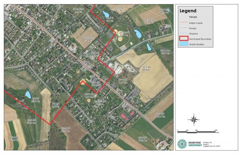
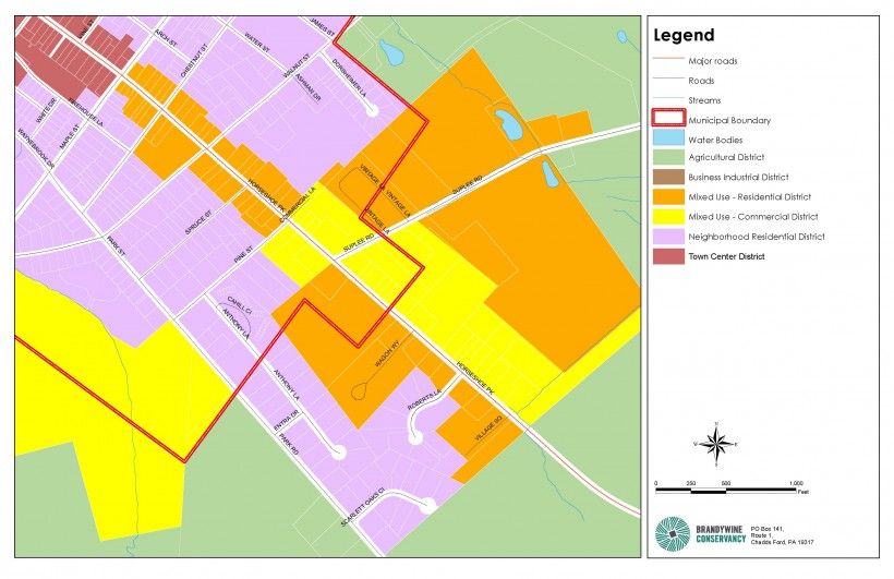
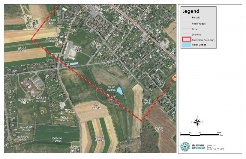
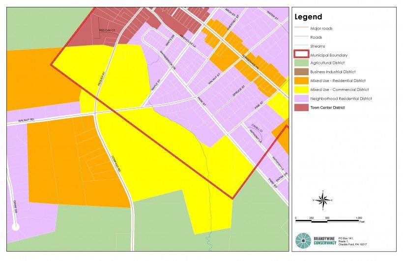
4. Excluding some uses from one zoning ordinance when included in the other zoning ordinance
Through their multi-municipal comprehensive plan and execution of an Intergovernmental Cooperative Implementation Agreement, the Township and Borough could exclude certain uses from their individual zoning ordinances provided that such uses were somewhere within their combined municipal boundaries. For example, the Borough excluded marijuana dispensaries, marijuana growers/processors and other industrial uses, and off-site advertising (billboards) from their new zoning ordinance since the Township agreed to provide for such uses in its new zoning ordinance. The Borough could do so without fear of a successful exclusionary zoning or residential fair share challenge—important benefits of two or more municipalities planning together.
5. Enabling the Transfer of Development Rights (TDRs) from the Township to the Borough for use by landowners and developers for future Borough development
Consistent with recommendations in its 2015 multi-municipal comprehensive plan, the Township’s new zoning ordinance included provisions that permitted TDRs generated from the Township to be used for development both Honey Brook municipalities. The Borough’s new zoning ordinance also included provisions that permitted its landowners or developers the ability to use TDRs generated from lands in the Township to enhance Borough development proposals in appropriate zoning districts. These TDRs could be used for additional residential density, additional non-residential impervious coverage and increased building height, subject to development plan approval. Before TDRs can be transferred from the Township to the Borough, both municipalities will need to execute an agreement for intermunicipal TDRs.
Adoption by Honey Brook Township and Borough of new, complementary zoning ordinances which are consistent with the previous multi-municipal comprehensive plan will be a significant implementation achievement. And, their collaborative efforts won’t end here, as the Township and Borough are finding other ways to work together for mutual benefit. In November 2017, both municipalities filed a joint MS4 permit with PADEP utilizing the assistance of the Conservancy’s water resources experts and Township and Borough stormwater engineers. This pioneering effort was one of three pilot MS4 projects undertaken in Chester County through the Christina Watershed Municipal Partnership, and the only one successfully submitted. This joint permit application enabled the Borough, which was challenged to find locations suitable within its borders to implement best management practices, to obtain MS4 credit for conservation practices installed on farms within the Township. Comments received this spring from PADEP on the joint MS4 permit have supported the coordinated efforts employed by these two municipalities.
Restoring American Shad to the Brandywine
American Shad are an anadromous fish—those that live primarily in the ocean and migrate each year up freshwater rivers to spawn. The largest member of the herring family, American Shad can be found along a significant portion of the east coast in Canada and the United States, from Newfoundland in the north to Florida in the south. Once prevalent in the region, American Shad were a staple in Native Americans’ and early colonialists’ diets. Shad were not only a significant food source, but were also an important part of the ecosystem, the economy, and the culture and identity of the Wilmington area and the Brandywine Valley.
Over time, the construction of dams along waterways impeded shad from their annual migration. In A Review and Recommendations Relating to Fishways Within the Delaware Basin (1985), a study commissioned by the Delaware Basin Fish and Wildlife Management Cooperative, three tributaries were identified as having “the greatest potential for restoration of the American shad”—the Lehigh, Schuylkill and Brandywine Rivers. The Brandywine Conservancy conducted shad restoration feasibility studies for both the Delaware (2005) and Pennsylvania (2009) portions of the Brandywine. However, the search for funding of shad restoration projects, such as dam removal, was difficult.
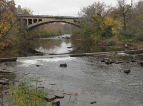
Later this year the West Street Dam—the southern-most dam on the Brandywine—is slated to be removed by the City of Wilmington, Delaware. Hunter Lott and Jim Shanahan, two Delawareans passionate about Shad restoration, reinvigorated the effort to advance the goal of bringing American Shad back to the Brandywine. After reaching out and engaging potential partners such as the Brandywine Conservancy, Hagley Museum and University of Delaware Water Resources Center, Lott and Shanahan formed a coalition of a diverse group of partners, with representation from many governmental entities and Delaware and Pennsylvania nonprofit organizations. Named Brandywine Shad 2020, the coalition is enthusiastic about bringing shad back to Brandywine and restoring a lost part of the region’s natural diversity and unique heritage. Lott and Shanahan now serve as co-directors of Brandywine Shad 2020.
A key next step for the coalition—updating the Delaware feasibility study—is a task that will be led by Dr. Gerald Kauffman of the University of Delaware Water Resources Center and two WRC associates, Martha Narvaez and Andrew Homsey.
“When finished, 12 river miles will have been reopened to American Shad between the tidewater at sea level, upriver to the Pennsylvania line, thus returning these anadromous fish to their historic spawning beds,” said Hunter Lott. “We forget that ever since the first dam was erected by Samuel Kirk near Adams Street in 1720, the Brandywine was a highly industrialized river. It was once considered the most important seat of manufacture in the new nation. Even today, the Brandywine is known as America’s most historic small watershed.”
According to Jerry Kauffman, “The river’s fall, during its journey in Delaware, is 165 feet—higher than height of Niagara Falls. So it is understandable that it became such a vital source of power for some 150 colonial mill dams during its industrial heyday.
“But the dams’ purpose ended a century ago,” Kauffman observed. “Now they serve to deprive Shad—plus striped bass and alewives—of their rightful spawning grounds, and continue to alter the natural habitat of the Brandywine River.”
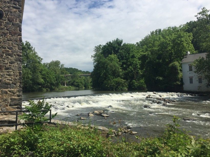
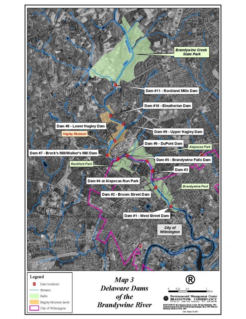
Three of the 11 dams in Delaware are already breached due to the relentless effects of natural forces. Jim Shanahan offered the following report on these 11 dams:
-
Dam #1—the so-called West Street Dam in the City of Wilmington, near the tidewater—is the one that’s furthest downstream and is scheduled to be removed by the City come October 2018.
-
Dam #2—along South Park Drive at DuPont Street—remains an essential dam, directing water to the City’s municipal drinking-water pumping station. But, by 2020, it will feature a rock-run fish passage on the river’s north bank.
-
Dam #3—at Mill Road—has been breached for years.
-
Dam #4—behind the former Bancroft Mills—has a non-functioning fish ladder that was built in the 1970s and has developed a hole in its downstream face. How to surpass this dam will be part of planned engineering studies.
-
Dam #5 crosses the river behind Rockford Park. Built in 1874, it is believed to be in sound structural condition. How Shad might bypass this dam also needs to be studied.
-
Dam #6 is behind the DuPont Experimental Station and future fish passage here also needs to be engineered.
-
Dam #7—at Breck’s Mill—and Dams #8, #9 and #10 all belong to Hagley Museum, which is a member of Brandywine Shad 2020.
-
Dam #11 at Rockland has been breached for decades.
Beast or Beauty? The Rain Garden of Upper Oxford Township
You may be familiar with the rain garden that is nestled in the gentle hillside to the north of the Upper Oxford Township building. Did you ever look at it and ask yourself, “Why isn’t the township keeping up with the landscaping next to the back parking lot?” If you were to ask a township official about it the response was probably, “That’s our rain garden.” It may not look like the lush and beautiful growth of flowers that one may expect at places like Longwood Gardens, but it is a “rain garden” all the same.
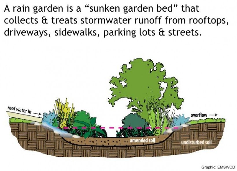
A rain garden is a term coined by stormwater engineers to combine function (capturing rain and runoff) with form (plants with a purpose). This concept of providing a place to capture runoff within a “garden” area arose from the experience of the expense and trouble of constructing large—and typically, concrete—structures to hold stormwater runoff. While they may be preferable to uncontrolled stormwater flow washing pollutants directly into creeks, the structures don’t allow water to soak into the ground. As a result, the streams and creeks near this type of boxy basin may have flow for only a short time after it rains during the hot and dry months of the year. In addition to decreasing water that can infiltrate the ground, the basin structure is generally not regarded as a thing of beauty.
The Upper Oxford Township rain garden was built in 2016 with funding provided by a grant from the Pennsylvania Department of Environmental Protection and PECO—with technical support from the Brandywine Conservancy. The garden captures a little more than an acre of stormwater runoff from the township building’s roof, driveways and parking lots and helps cleanse the pollutants that may be coming off the roof and paved/grassy areas. There may be metal particles, oil and grease residue and lawncare chemical residue that is washed off those surfaces with the rain. The rain garden has plants that will help capture and break down the pollutants so that cleaner water soaks into the ground or flows out to Muddy Run, a tributary of Octoraro Creek East. The flow passes through Octoraro Reservoir—a drinking water source—on its way to the Chesapeake Bay.
What are the amazing plants that help clean the stormwater?
The Brandywine Conservancy and the Parks and Recreation Committee of Upper Oxford Township did a partial inventory in July 2018 and found that there were some beneficial plants and some that are bad actors. A few of the “beauties” that were found are shown below:
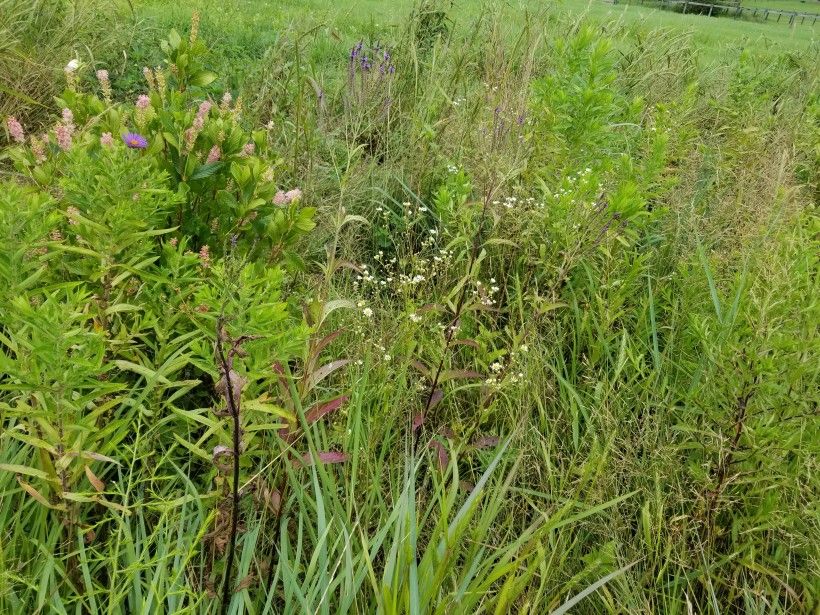
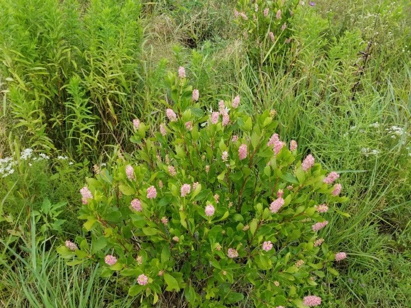
Staff observing the flowering plants were excited to see at least seven different species of butterflies enjoying the nectar from their blooms! Native plants are preferred in rain gardens due to their hardiness and ability to flourish without frequent or specialized care. The plants in the Upper Oxford Township rain garden are placed in zones so that ones that prefer wet conditions are located where the water ponds; plants that are suited to either wet or dry conditions are positioned at the upper area and along the edges.
Staff also saw a number of plants that provide important functions, but are not particularly appealing because they aren’t flowering plants. In particular, panicum is a tall grass with thin leaves and a robust, brushy seed head. It is growing in many areas along the edge of the rain garden. To the untrained eye it looks like a tall weed, but this hero provides food for the wildlife during the barren winter months.
A community of water loving plants—such as soft rush, slender rush, monkey flower, swamp milkweed and woolgrass—are thriving in the lowest portion of the rain garden. This area holds water for a few days after it rains. The ponding issue will soon be evaluated to see if there is a way to reduce the number of days of ponded water without disturbing the established plant community.
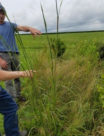
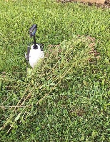
The “beasts” that were observed included purple loosestrife, reed canary grass, blue chicory, oriental bittersweet, Broadleaf plantain and curly dock. Fran Sharon, a member of the Parks and Recreation Committee of Upper Oxford Township, took action to remove and treat the base of the purple loosestrife the day after the plant inventory.
While it’s a little complicated to take care of the rain garden, a landscape company—GreenWeaver Landscapes—has been maintaining it for the post-construction period while the plants are getting established. Since the company’s contract is nearly complete, future maintenance will be done by the Upper Oxford Township Public Works department. The Brandywine Conservancy is working on guidance for plant management so that the Public Works staff will have the necessary information to keep this community asset looking and functioning like a beauty!
If you have any questions regarding the rain garden, please contact the Upper Oxford Township Parks and Recreation Committee. Sylvia Pope at the Brandywine Conservancy is also happy to answer your questions. You may reach her at [email protected] or by phone at 610-388-8352.
Brandywine Conservancy & Museum of Art Seeks Renewal of Accreditation through the Land Trust Alliance
The land trust accreditation program recognizes land conservation organizations that meet national quality standards for protecting important natural places and working lands forever. The Brandywine Conservancy & Museum of Art is pleased to announce its application for accreditation renewal. A public comment period is now open.
The Land Trust Accreditation Commission, an independent program of the Land Trust Alliance, conducts an extensive review of each applicant’s policies and programs. Ellen Ferretti, Director of the Brandywine Conservancy, noted: “Accreditation ensures that the Brandywine holds itself to the highest professional standards in the land trust field. It provides confidence to our landowners, constituents, members and donors that this organization can responsibly fulfill the promise of preserving and stewarding our working and natural resources for generations to come.”
The Commission invites public input and accepts signed, written comments on pending applications. Comments must relate to how the Brandywine Conservancy & Museum of Art complies with national quality standards, which address the ethical and technical operation of a land trust. For the full list of standards or to learn more about the accreditation program, please visit www.landtrustaccreditation.org. Comments can be submitted online, emailed to [email protected], faxed to 518.587.3183 or mailed to: Land Trust Accreditation Commission, Attn: Public Comments, 36 Phila Street, Suite 2, Saratoga Springs, NY 12866.
The deadline for comments on the Brandywine’s application is December 14, 2018.