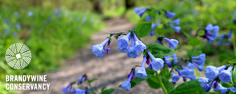
Directors' Report
Dear Fellow Conservationists,
It’s that time of year when the world transitions from gray to technicolor. It reminds us of renewal and the hope for a beautiful spring!
The Conservancy is busy gearing up for the warmer weather, and in this issue of Environmental Currents we are sharing some resources as we enter a new season. This includes information on Beech Leaf Disease, which we are seeing in our Penguin Court Preserve in Western Pennsylvania, as well as an Invasive Species Spotlight on Dame’s Rocket, which is often construed as native.
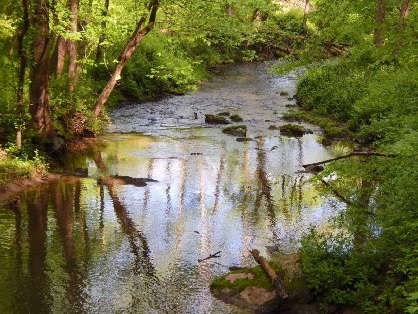
We are continuing with our flood recovery, and if you find yourself on our campus in Chadds Ford over the next several months, you will see there are many active construction projects. We are rebuilding our inner campus to ensure that we can serve the public for generations to come. As a part of the flood recovery effort, the Conservancy is leading the Brandywine Flood Study in partnership with the Chester County Water Resources Authority and the University of Delaware Water Resources Center. Slated to wrap up this summer, the study seeks to better understand why and where flooding occurs in the Brandywine watershed. It will also set a roadmap for flood mitigation strategies to protect our community in the long run.
We are seeking input from the public through this flood study and we need to hear from you! Please take our public input survey and add to our interactive flood map so that we can receive feedback on your own flooding observations in the watershed. We hope the result of this study will not only make our communities along the Brandywine more resilient to flooding, but it will also serve as a model to other communities nationally to effectively address their flooding issues, too.
We are thankful for your support of conservation. Together, we can tackle our environmental challenges today for a more sustainable tomorrow.
— Stephanie and Grant
Stephanie Armpriester, Director of Conservation and Stewardship
Grant DeCosta, Director of Community Services
Agriculture Spotlight: Spring

Spring is here—the birds are chirping, the spring ephemerals are blooming, and farmers are coming up on one of their busiest seasons of the year. As we have discussed in prior agricultural spotlights, there is no down time in the life of a farmer, and thanks to their hard work over the winter, fields are ready for the upcoming planting season.
Click here to read more
Invasive Species Spotlight: Dame's Rocket
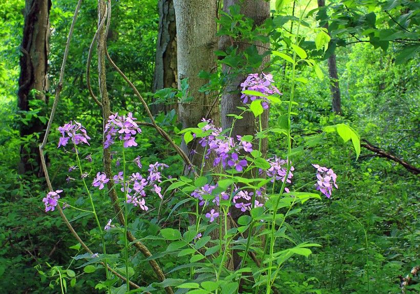
Introduced in New England in the 1600s during European settlement, dame’s rocket established quickly and has spread throughout the entirety of the United States, except for several states along the southern border. Its long-standing establishment has led to the misconception that it is a native wildflower, reflected in the fact that it is often a component in commercially available wildflower mixes used today. With no natural predators or diseases in North America, this invasive can out-compete natives, leading to a decrease in diversity.
Click here to read more
Beech Leaf Disease is Coming Your Way
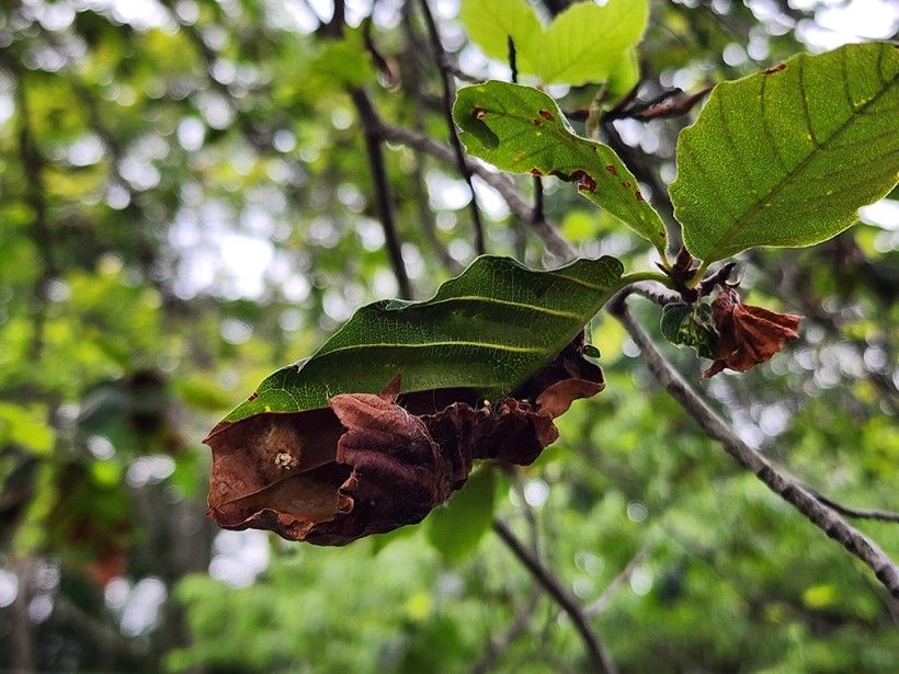
Beech Leaf Disease—caused by an emergent species of microscopic nematode—is wreaking havoc on beech tree (Fagus spp.), which are ecologically and aesthetically important trees across the eastern U.S. and Canada. In the blog below, Brandywine’s Penguin Court Program Manager, Melissa Reckner, shares her firsthand experience, including how to spot the signs and the importance of raising awareness for this disease with no known cure.
Click here to read more
Penguin Court Native Plant Sale
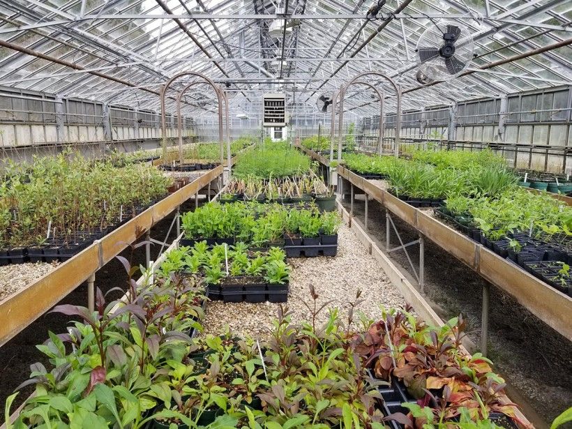
Over the past several months, Penguin Court has been stratifying, sowing, and potting up thousands of seedlings in preparation for spring plant sales. Online orders for both Penguin Court's Native Plant Sale and our partnership native plant sale with Indiana County Friends of the Parks are now open! Plant pickups will be scheduled at Penguin Court on May 3 and 4, while plants sold through our partnership with the Indiana County Friends of the Parks can be picked up on May 11 at Blue Spruce Park in Indiana, PA.
93rd Radnor Hunt Races
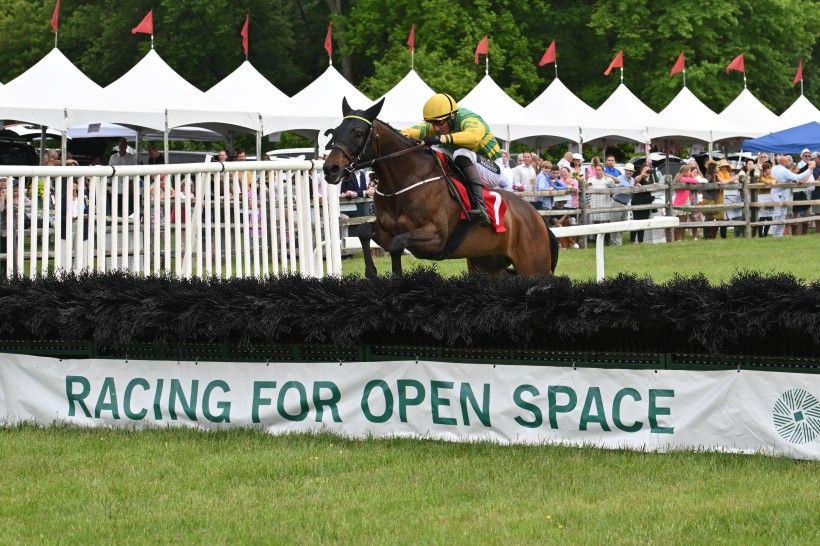
Celebrating 93 years of horseracing on the Main Line, the Radnor Hunt Races return on Saturday, May 18, 2024 in Willistown Township, Chester County. Tickets are now on sale, and must be purchased by May 8, for this springtime tradition that draws the best thoroughbred horses, riders and trainers from across the country. All event proceeds benefit the open space and clean water programs of the Brandywine Conservancy—the sole beneficiary of the Races for the last 44 years.
Mobility Mapping at Kendal-Crosslands Communities
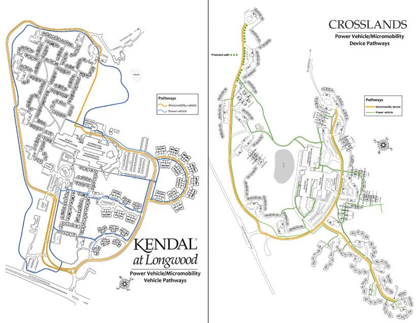
Kendal-Crosslands Communities (KCC) is a not-for-profit Life Plan Community located in Kennett Square, PA, with four campuses totaling approximately 500 acres. The Brandywine Conservancy and Kendal-Crosslands Communities have had a relationship for over 40 years, since the Conservancy accepted the first of two conservation easements on a portion of their property. As part of our duty as the easement holder, Conservancy staff monitor these easements yearly.
During one of these visits in the early 2000s, KCC grounds staff inquired about the mapping capabilities of the Conservancy and whether they would be available to assist in locating and mapping the trails at their main campus. Working with KCC staff and resident members of the trail groups within each Community, Conservancy staff collected trail data via GPS field work and created a series of printed maps for resident use while hiking throughout their property.
Over the past 20 years, beginning with the Community trail maps, the Conservancy has worked with Kendal-Crosslands on numerous occasions, collaborating with both grounds staff and residents of the Communities. Some of these projects include natural area management plan mapping, spray field mapping, tree canopy mapping, providing maps for the Kendal Crosslands Arboretum, and development of a watershed plan for Bennetts Run, which flows between Kendal and Crosslands.
This fall, the Conservancy was once again able to work with Kendal-Crosslands staff on a mapping project to illustrate pathways within the main campus that are accessible using various forms of vehicles, such as power vehicles (wheelchairs, scooters) and micromobility vehicles for recreation (bikes, ebikes). The resulting maps will be available around the campus for residents and visitors to help navigate throughout the communities.
Piedmont Spotlight: Coastal Plain Forest Communities
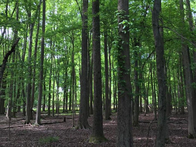
Join us as we continue our exploration of the vegetative communities of the Piedmont region of the Eastern United States. In this ongoing series of blogs, we will spotlight specific vegetative communities, define their historic structures, describe the processes that created them, examine past and ongoing threats to their survival, and provide suggestions for long-term, sustainable forest management to help steward them into the future. In this spotlight, we’ll highlight two forest communities: the Sweet Gum – Oak Coastal Plain forest and the Red Maple – Magnolia Coastal Plain palustrine forest.
Click here to read more
Brandywine Conservancy & Museum of Art Seeks Accreditation Renewal
The Brandywine Conservancy & Museum of Art is pleased to announce it is applying for renewal of its land trust accreditation. The land trust accreditation program recognizes land conservation organizations that meet national quality standards for protecting important natural places and working lands forever. As part of the reaccreditation process, a public comment period is now open for Brandywine’s application.
The Land Trust Accreditation Commission, an independent program of the Land Trust Alliance, conducts an extensive review of each applicant’s policies and programs every five years. The Commission invites public input and accepts signed, written comments on pending applications. Comments must relate to how the Brandywine Conservancy & Museum of Art complies with national quality standards, which address the ethical and technical operation of a land trust. For the full list of standards or to learn more about the accreditation program, please click here.
Comments can be submitted online, emailed to [email protected], or mailed to: Land Trust Accreditation Commission, Attn: Public Comments, 36 Phila Street, Suite 2, Saratoga Springs, NY 12866. The deadline for comments on the Brandywine’s application is July 1, 2024.
Brandywine Creek Greenway Mini-Grant Program
After successfully awarding funds in Round 4 for park enhancements, ecological restoration, and recreation opportunities, we are excited to continue the Brandywine Creek Greenway’s Mini Grant Program this spring. This funding, provided through PA Department of Natural Resources, grants awards from $2,000 to $25,000 for projects that support and advance the goals and objectives of the Greenway’s Strategic Action Plan.
Information on the Brandywine Creek Greenway’s Mini-Grant Program and previously funded projects can be found on the Mini-Grant Program website. Eligible applicants include Pennsylvania non-profit organizations with tax-exempt status 501(c)(3), municipalities, counties and some educational institutions.
Greenway Strategic Action Plan: Public Survey Now Open
We want to hear from you! Please consider participating in a brief survey that will help guide the goals and projects of the Brandywine Creek Greenway over the next 10 years. Click here to take the survey!
The Brandywine Creek Greenway is a regional planning initiative conducted by the Brandywine Conservancy that serves 29 townships in both Delaware and Pennsylvania and the communities along the entire 40 miles of the Brandywine Creek. Click here to learn more about the Strategic Action Plan Update.
The Greenway is funded by the William Penn Foundation to foster conservation of historic and natural resources, preserve open space, increase recreational opportunities, access and development of trails and trail connectors, while cultivating community and climate resilience and supporting the vibrancy of our local economies.
Serving 29 townships in Pennsylvania, Delaware, and the communities along the entire 40 miles of the Brandywine Creek, the Greenway strives to foster conservation of historic and natural resources and preserve open space, while increasing recreation opportunities, access and development of trails and trail connectors to support the growth our vibrant local economies.
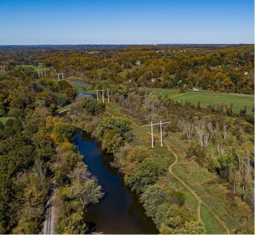
Help Guide the Brandywine Flood Study!
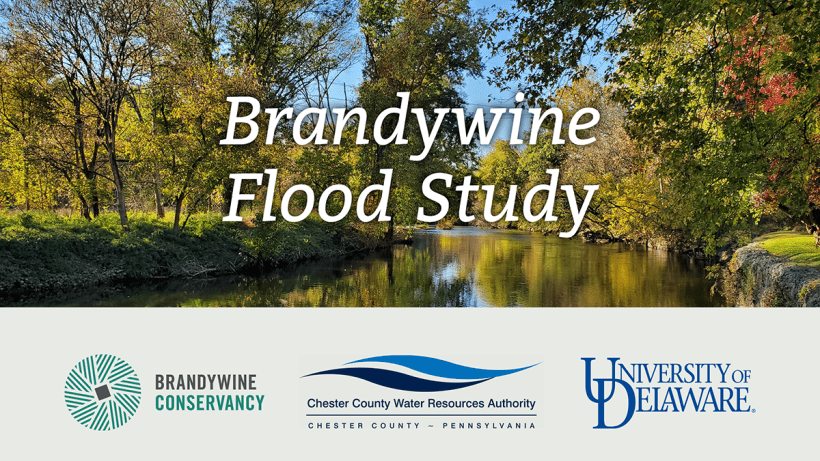
Led by the Brandywine Conservancy in partnership with the Chester County Water Resources Authority and the University of Delaware Water Resources Center, the Brandywine Flood Study is a coordinated effort to better understand where and why flooding occurs along the Brandywine Creek in both PA and DE, and to identify the best approaches to protect our communities from future severe flooding events.
To help guide this comprehensive study, please click here to take our public input survey or click here to engage with our interactive flood study map.
Using these tools will help better inform us about local flooding issues along the Brandywine Creek, including to help us identify other causes of flooding due to things like infrastructure problems and more. You can also submit photos of flood events or areas of concern. You do not need to live in the Brandywine watershed to provide input on how flooding impacts places you may also work, play, travel through, rely on for services, or support being made more resilient against future flooding.
Meet Our New Conservancy Staff


Michael Mingus joined the Conservancy as a Lead Planner. Michael previously worked for the USDA Natural Resources Conservation Service as a Wildlife Biologist. In that role, he provided wetland and wildlife habitat conservation planning and technical assistance for land and water restoration projects. He also conducted monitoring of conservation easements and worked with landowners to address natural resource and easement compliance issues. Recently, Michael worked for the Maryland Environmental Trust and Berks Nature where he conducted landowner outreach and negotiated new conservation easement projects. In his role as Lead Planner at the Conservancy, Michael oversees new conservation easements, easement amendments, and fee acquisition projects.
Emma Heffer joined the Conservancy as an Assistant Planner. Emma has a B.S. in Environmental Studies with a minor in Latin American and Caribbean Studies from the University of Vermont and has land trust experience through two internships at Boothbay Region Land Trust and Vermont River Conservancy. In her new role, Emma provides project support to new conservation easements, easement amendments, and fee acquisition projects.