These toolkits are designed to equip municipalities and other stakeholders with valuable resources for advancing natural and cultural resource conservation, enhancing recreation and transportation systems, and fostering resilience.
Each tool includes an overview that outlines the relevant issues it addresses, a guide on how to implement it, its regional applicability, and a list of case studies. Some toolkits include an additional technical bulletin that provides more detailed guidance such as a step-by-step implementation process and supplementary resources for deeper exploration.

Comprehensive Plans
A Comprehensive Plan is a long-term strategic guide for a municipality's development, covering areas like land use, infrastructure, housing, transportation, economic growth, and environmental protection. It sets a vision for the future and helps shape decisions.
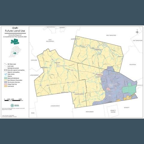
Future Land Use Planning
A Future Land Use analysis offers a geographic vision for how land within a municipality is expected to evolve. It outlines anticipated development types, access to municipal amenities, supporting infrastructure and services, and the preservation of natural and historic resources.
Multi-Municipal Planning
Multi-municipal or regional planning involves collaboration between neighboring municipalities, such as townships and boroughs, to share costs, plan across boundaries, and consider shared services for traditional municipal projects.
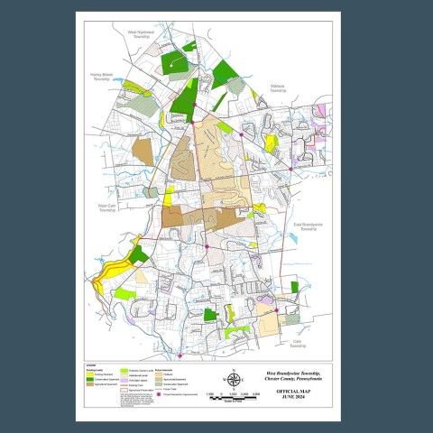
Official Map
An official map is a tool that helps municipalities guide future growth, aligning with the goals of their Comprehensive Plan. It includes a map and ordinance that legally designate the locations of streets, waterways, parks, and other public lands or facilities.
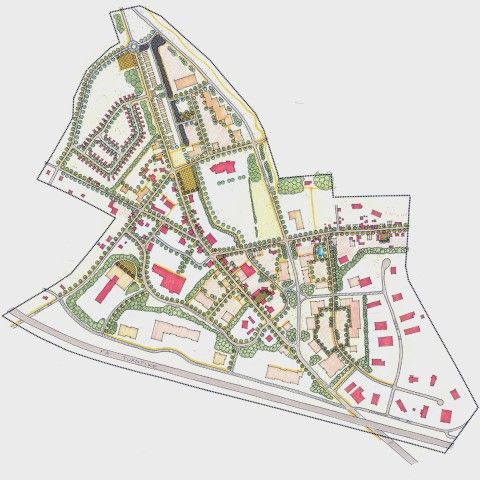
Sketch Plans
The submission of a sketch plan provides an opportunity for the applicant to meet with municipal officials allowing both parties to discuss the project at the conceptual level before the preliminary engineering begins.