These toolkits are designed to equip municipalities and other stakeholders with valuable resources for advancing natural and cultural resource conservation, enhancing recreation and transportation systems, and fostering resilience.
Each tool includes an overview that outlines the relevant issues it addresses, a guide on how to implement it, its regional applicability, and a list of case studies. Some toolkits include an additional technical bulletin that provides more detailed guidance such as a step-by-step implementation process and supplementary resources for deeper exploration.
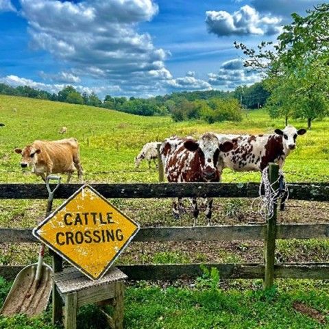
Agricultural Best Management Practices
Agricultural Best Management Practices (BMPs) refer to a set of strategies, methods, and technologies implemented by farmers and land managers to minimize the environmental impact of agricultural activities.
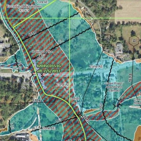
Floodplain Regulations
Floodplain regulations are used to protect the natural connection between streams, rivers, and their floodplains while also safeguarding communities from costly flood damage by preventing inappropriate land use and the storage of hazardous materials that could cause significant ecological and health impacts during a flood.

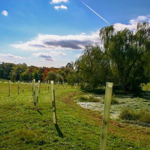
Native Plants
A native plant is a species that naturally occurs in a specific region, ecosystem, or habitat without human intervention. These plants have evolved and adapted to the local climate, soil, and other environmental conditions over a long period of time.
Riparian Buffer Regulations
Riparian buffer regulations are established by municipalities to protect the vegetated areas along watercourses, such as streams, rivers, and lakes, by requiring the preservation or restoration of natural buffers.
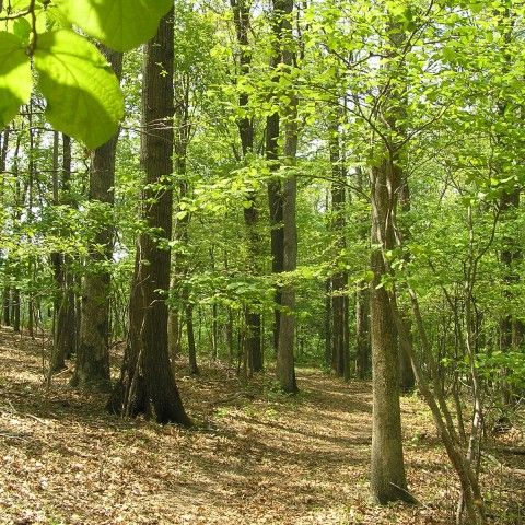
Woodland Classification
A Woodland Classification is a GIS assessment evaluating ecological attributes such as interior woodland extent and watershed functions, including slope stabilization and headwater protection, to support comparison of municipal and regional woodlands.

Woodland Protections
Woodland Protection regulations are implemented through the Zoning or Subdivision and Land Development Ordinances. These resource protection standards may impose use limitations, prohibitions, disturbance thresholds, or performance requirements.