Director's Report
Welcome to our summer issue of Environmental Currents!
There has been a lot of activity at the Brandywine Conservancy and we hope you enjoy reading our articles on all that we are working on—from evolving, ongoing programs and projects to fun and informative events.
We cover a lot of ground in this issue: new zoning provisions for timber harvesting; stewardship tips; a report on the recent Clean Water Conference; our new partnership extending the Brandywine Creek Greenway into Delaware; and so much more.
As summer ramps up, we hope you'll take a moment to look up, look around and take a walk outside—and if you need some ideas, all of our upcoming programs and events provide a great opportunity for outdoor explorations.
As always, thank you for your ongoing support and partnership with the Brandywine Conservancy. We have a lot to be thankful for due to all the conservation and planning efforts of the last 50 plus years that have protected this beautiful place we call home.
Ellen
Ellen M. Ferretti
Director, Brandywine Conservancy
P.S. Please contact us or drop by if you would like a copy of the Brandywine-Christina State of the Watershed Report.
New Zoning Provisions for Timber Harvesting

For years the Conservancy has helped this region’s municipalities protect woodland resources from indiscriminant clearing due to development and has promoted long-term woodland and forest management. In our experience, protecting woodlands from damage or loss by regulating development can be far easier than trying to protect the same woodlands from a wayward timber harvest. This is due to Pennsylvania laws that limit a municipality’s ability to regulate timber harvesting either for forestry practice or when clearing woodlands for cultivation or grazing. A two-year effort by the Conservancy’s Municipal Assistance Program (MAP) to improve how municipalities can effectively manage forestry/timber harvesting as a land use regulated through zoning has led to new “model” ordinance language.
MAP’s new zoning ordinance language meets three objectives: 1) to provide municipal officials and their staff the opportunity to collaborate with county and state agencies responsible for review and permitting of timber harvests in their municipality, 2) to work with woodland owners to minimize adverse environmental impacts from timber harvesting, and 3) to be consistent with Pennsylvania laws. While developing this model ordinance language, MAP staff obtained input from several stakeholders, including the Chester County Conservation District, Pennsylvania Department of Conservation and Natural Resources’ Bureau of Forestry, the Chester County Planning Commission, a municipal solicitor, and representatives from the forest products industry. A MAP Subscribers meeting was also held on this subject in the fall of 2017 which included a panel of the above-listed stakeholders.
Special-purpose language addressing forestry found in the Pennsylvania Municipalities Planning Code (MPC) states: “Zoning ordinances may not unreasonably restrict forestry activities. To encourage maintenance and management of forested or wooded open space and promote the conduct of forestry as a sound and economically viable use of forested land throughout the Commonwealth, forestry activities, including but not limited to, timber harvesting, shall be a permitted use by right in all zoning districts in every municipality.”
While zoning ordinances now list forestry and timber harvesting as a permitted use by-right in all zoning districts, how those activities might be further regulated within an ordinance can vary from municipality to municipality. For example, some ordinances require the submittal of a timber harvesting plan for municipal approval prior to initiating such activity; some limit, or prohibit, timber harvesting on steep slopes or within floodplains and wetlands; and some require replanting of heavily harvested areas.
In administering Pennsylvania’s Agriculture, Communities, and Rural Environment Act (ACRE)—which bars a municipality from adopting or enforcing a local ordinance prohibited or preempted by state law—the Pennsylvania Attorney General’s (AG) Office recently took exception with a northern Chester County township’s timber harvesting regulations. In a 21-page letter, the AG’s Office stated that forestry or timber harvesting is a form of agriculture (e.g. silviculture) and is protected from unreasonable zoning restrictions by several Commonwealth laws focused on agriculture—including the Right to Farm Act (RTFA) and the Agricultural Area Security Law (AASL). In addition, the AG placed regulatory responsibility for timber harvesting operations with PADEP under PA Section 102, Erosion and Sedimentation Control, and PA Section 105, Dam Safety and Waterway Management. The AG stated that under ACRE, a municipality’s ability to regulate forestry/timber harvesting is pre-empted by PADEP and found this municipality’s ordinance to be in violation of ACRE. In order to correct this violation, the AG directed the township to amend its zoning ordinance by striking numerous timber harvesting provisions and changing others through suggested language. In its letter, the AG frequently cited forestry practice expertise of Penn State University scientists to qualify its findings and recommendations.
MAP’s new forestry/timber harvesting provisions include a comprehensive set of terms and definitions used in the new ordinance language. These terms and definitions follow the recommendations provided by the State AG in the northern Chester County case. Definitions were also drawn from PA Chapter 102, Pennsylvania Model Forestry Regulations, published by the Penn State School of Forest Resources; Forest Stewardship, Planning Your Forest’s Future, published by Penn State Extension (#6); Best Management Practices for Pennsylvania Forests, published by Penn State College of Agricultural Sciences; and the Model Riparian Forest Buffer Protection Overlay District, 2nd Edition, published by the Pennsylvania Land Trust Association.
Following the definitions, supplemental regulations are proposed and apply to forestry/timber harvesting uses permitted by-right in each of the zoning districts within the ordinance. These model provisions were also written to steer clear of most of the objectionable provisions found by the State AG with the northern Chester County municipal ordinance.
As stated in the Conservancy’s supplemental regulations, when a landowner plans to conduct a timber harvest, an application for zoning permit must be filed with the municipality at least 45 days prior to the start of the harvest. The municipality has 30 days to either approve the zoning permit application and issue the zoning permit or deny the application. Two different procedural paths are provided for obtaining zoning permit issuance. One requires the submittal of a timber harvesting plan prepared by a professional forester, which includes an existing features plan and a logging plan, as well as the submittal of other permit related information when applicable. Submittal of this timber harvesting plan would be required whether a landowner is clearing woodlands for cultivation or grazing, or as a long-term silvicultural practice.
A second and simpler application path for zoning permit approval is provided for landowners who are enrolled in the PA Bureau of Forestry’s Forest Stewardship Program and have a stewardship plan prepared by a professional forester for their property. When a timber harvest is to be undertaken consistent with a landowner’s stewardship plan, the landowner or his/her professional forester completes a Treatment Unit Sustainability Assessment Form (TUSAF) available through the Bureau of Forestry’s District Office. This completed form is then reviewed and approved by the District Forester, and then filed with the municipality to obtain a zoning permit for the planned timber harvest.
This simpler process provides a regulatory incentive to woodland owners that manage their resource for the long-term and is an outcome of the fall MAP Subscriber meeting on forestry. Ordinance language offering this simpler forest steward option for municipal timber harvesting approval had already been offered by staff of Natural Lands working together with Bureau of Forestry staff, to a northern Chester County municipality. Natural Lands generously permitted this incentive to be included as part of our model ordinance provisions.
The new forestry/timber harvesting provisions are designed to complement the Conservancy’s model riparian buffer protection standards for zoning ordinances, and its woodland protection provisions written to help municipalities with land development proposals. In Chester County, adopting these new forestry/timber harvesting provisions at the municipal level should also reinforce the Chester County Conservation District’s administration of PA Section 102 erosion and sedimentation control regulations for timber harvesting activities undergoing District review and approval. Municipalities interested in obtaining MAP’s new model forestry/timber harvesting ordinance language should contact [email protected].
Upcoming Calendar of Events
Conserved Lands Tour
Saturday, June 23
Tip-a-Canoe and Barbecue, too!
Saturday, July 14
Hike a Loop Trail at the Laurels Preserve
Sunday, July 22, 2018
Summer Garden Walk
Wednesday, July 25
Farm to Table Dinner
Wednesday, August 22
Brandywine Battlefield Driving Tour
Saturday, August 25
Early Fall Migrant Bird Walk at the Laurels Preserve
Wednesday, September 12
Fern ID Walk in the Laurels Preserve
Saturday, September 15
Fall Garden Walk
Wednesday, September 19
Harvey Run Trail Walk: Finding Natural Wonders
Thursday, September 27
Bike the Brandywine
Saturday, September 22
Palette to Palate
Saturday, September 29
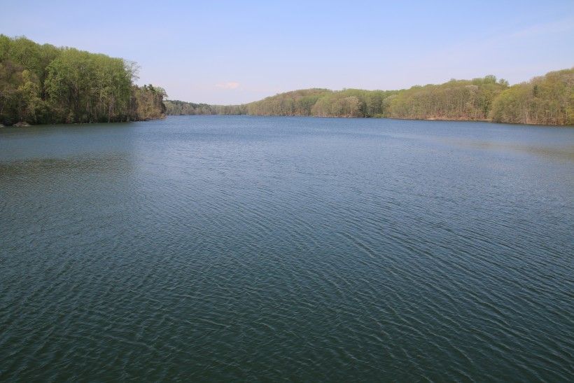
Brandywine Creek Greenway Extends in Delaware
The Brandywine Creek Greenway is a 30-mile long conservation corridor along both branches of the Brandywine that stretches from the Delaware state line just south of Chadds Ford to the Pennsylvania Highlands Mega-Greenway at the northern border of Honey Brook Township. This regional planning initiative connects 27 municipalities across two counties, Chester County and Delaware County, within the Commonwealth of Pennsylvania. The vision of the Brandywine Creek Greenway is to build healthier, more sustainable communities, by emphasizing the natural and cultural resources of the area, preserving and protecting the Brandywine River, and creating connections among open space, parks, river access points and area attractions.
To facilitate the implementation of the next phase of the Brandywine Creek Greenway, the William Penn Foundation has generously provided a $435,000 grant to the Brandywine Conservancy. Over the next two years projects in seven focus areas will be developed. These focus areas include: the Water Trail Study and Master Plan; High Trail Bridge Grant Preparation; a Creek Access and Kayak Launch Concept Plan; an Interpretive Display at Martin’s Tavern; an Urban Park in Modena Borough Park; the Beaver Creek Trail Study; and the Brandywine Creek Greenway Extension into Delaware.
Over the next two years the Conservancy and Delaware Greenways will collaborate with key stakeholders in the region to extend the Brandywine Creek Greenway into New Castle County, Delaware, through the City of Wilmington, to the Christina River. These stakeholders include City of Wilmington; New Castle County; Wilmington Area Planning Council; Delaware Department of Transportation; Delaware Department of Natural Resources and Environmental Control; Delaware Nature Society; The Nature Conservancy in Delaware; The Conservation Fund; National Park Service; and more. When completed, the Brandywine River in its entirety, from the headwaters in Honey Brook Township, Pennsylvania to the Christina River in Wilmington, Delaware, will be part of the Brandywine Creek Greenway. This extension into Delaware will lengthen the Greenway by an additional 10 miles, resulting in a 40-mile long conservation corridor in total.
This new initiative continues earlier efforts by the Conservancy to help protect the Brandywine-Christina Watershed’s land, water, natural and cultural resources in the State of Delaware. Previous work includes collaborating with New Castle County to develop a stormwater management Best Management Practice (BMP) manual and working with landowners to protect and preserve their property with conservation easements. To date, Brandywine Conservancy has helped ease a total of 1,891 acres of land in New Castle County. Most recently, the City of Wilmington and the Brandywine Conservancy have worked closely on the city’s Source Water Protection Program, helping preserve land and install BMPs at the headwaters in Honey Brook Township to protect the water quality of the Brandywine River.
Stormwater Management Updates
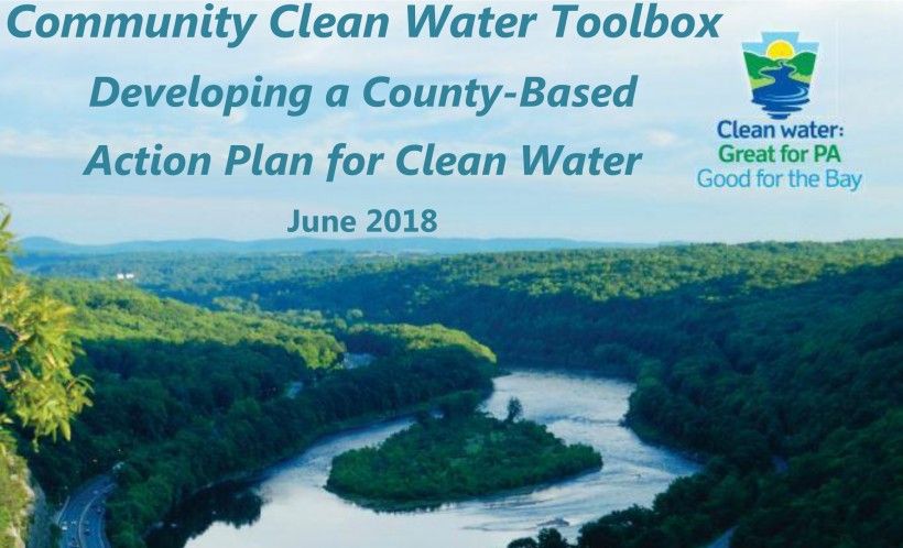
Community Clean Water Toolbox Released to Guide Chesapeake Bay Cleanup Efforts
The Pennsylvania Department of Environmental Protection (PA DEP) recently announced the launch of the Community Clean Water Toolbox to meet the goals of Pennsylvania’s Phase III Watershed Implementation Plan (WIP). Toolboxes will be developed and released over time for each PA county within the Chesapeake Bay Watershed. The toolbox will provide useful data to guide local partners to collaboratively work together to improve water quality by 2025.
Brandywine Conservancy’s Collaborative Stormwater Efforts in the Delaware River and Chesapeake Bay Watersheds
The Brandywine Conservancy has been working with several Chester County municipalities to provide technical assistance to meet their stormwater regulations. Last year, Honey Brook Township and Honey Brook Borough worked with the Christina Watersheds Municipal Partnership (CWMP), including the Conservancy and Brandywine Red Clay Alliance, to develop a joint Total Maximum Daily Load (TMDL) plan to meet pollutant reduction targets in the Brandywine-Christina Watershed, a subwatershed of the Delaware River. The Borough and the Township adopted a joint comprehensive plan, developed by the Conservancy in 2015, to shape future land use on a regional scale. Honey Brook Township—mostly rural, with active dairy farm operations—provided more open space and agricultural land to implement cost-effective green infrastructure Best Management Practices (BMPs). The Borough—with a high percentage of impervious surface coverage from development and little room for stormwater BMPs—partnered with the Township to expand the MS4 planning area to install BMPs, enabling the Township to meet reduction requirements. The proposed BMP projects included a riparian buffer on a preserved farm, and a rain garden and riparian buffer planting in the Township’s Umble Park. The project exemplifies how working on a regional basis can effectively and efficiently improve water quality at the headwaters of the Brandywine-Christina Watershed. The Conservancy, municipalities and the CWMP are actively working with PA DEP to make adjustments to the joint TMDL plan for approval.

In the Chesapeake Bay Watershed, the Conservancy and University of Maryland’s Environmental Finance Center (EFC) have been working with the Oxford Region municipalities to develop a regional stormwater management program to help restore and protect streams that flow into the Bay. The Oxford Region municipalities have worked to identify opportunities for collaboration with stormwater management among Oxford Borough and the five Townships (Upper Oxford, Lower Oxford, East Nottingham, West Nottingham and Elk), as well as the Chesapeake Bay portions of Penn and New London Townships. While the municipalities applied for individual permit applications and individual Pollutant Reduction Plans (PRPs) for this permit round, the Conservancy is working with the municipalities on areas of collaboration in the future. This may include opportunities to work with each other on public education and outreach, administration activities, operation and maintenance, and implementation of BMPs in the long-term. These opportunities have the potential to provide cost-savings to the municipalities as well as benefits to water quality and other ecosystem functions. To date, this project has resulted in: completion of data collection and mapping of the municipal storm sewer systems for all municipalities and draft PRPs for three of the six municipalities. Work continues for collaboration with stormwater management among the Oxford Region via a financing feasibility study being developed by EFC this year.

Clean Water Conference Draws a Crowd

Over 160 people packed the ballroom at the Mendenhall Inn on May 3rd to attend a one-day Clean Water Conference hosted by a partnership of six local non-profit organizations—including the Conservancy—who are focused on protecting and restoring water quality within the Brandywine-Christina watershed. One of the most historic small watersheds in the nation, the Brandywine-Christina supplies drinking water to over a half-million people in Delaware and Pennsylvania and supports $1.6 billion in annual economic activity and over 100,000 jobs.
Funded by the William Penn Foundation through its Delaware River Watershed Initiative (DRWI), the Brandywine-Christina Watershed Partners consist of the Brandywine Conservancy, Brandywine Red Clay Alliance, Natural Lands, Stroud Water Research Center, The Nature Conservancy in Delaware and the University of Delaware Water Resources Center. These Partners were tasked with leading efforts in the Brandywine-Christina Watershed—one of the eight targeted areas within the Delaware River Basin that was identified by the DRWI as a priority zone where interventions could significantly safeguard or improve clean water. The Partners have spent the last four years working together to reduce critical stressors to this watershed.
As a result of their first phase of collaborative efforts, the Partners shared their work and findings with conservationists and policy makers at the Clean Water Conference and unveiled the “Brandywine-Christina State of the Watershed Report”— a comprehensive 88-page booklet highlighting projects they and others have implemented throughout the watershed over the past four years. The conference also featured Andrew Johnson, Program Director, William Penn Foundation; Shawn Garvin, Secretary, Delaware Department of Natural Resources and Environmental Control; Patrick McDonnell, Secretary, Pennsylvania Department of Environmental Protection; and Colin O’Mara, President and CEO, National Wildlife Foundation. Following the presentations, conference attendees visited a local farm—where agricultural best management practices have been implemented—and Hoopes Reservoir for an on-site discussion about water supply options and strategies for protecting source water in the watershed.

As outlined in the “Brandywine-Christina State of the Watershed Report,” there are still many opportunities for improvement within the watershed. Sprawling growth on the edge of the Philadelphia and Wilmington metro areas compounds the water quality effects of agricultural activities which combine to produce excessive sediment, nitrogen, phosphorus and bacterial runoff. The competition for land has also played out with classic results: natural habitat and forest cover have been diminished, and water quality suffers further from chemicals, high temperatures and stormwater runoff. Continuing challenges include on-going and projected increases in land development and impervious cover, constant and increasing nitrogen levels, increasing chloride levels from road salt, and an impairments rate of streams in the watershed of more than 50%.
There have also been some successes in water quality. Dissolved oxygen (DO) levels have improved in many streams. Numerous streams are experiencing reduced levels of phosphorus and sediment loading and decreases in bacteria levels have also been observed in the Brandywine and Red Clay Creeks.
Improvements are also being made through collaborative planning efforts, land protection and agricultural restoration approaches. Focusing on headwater streams, the Partners deployed four main strategies: land protection, through the purchase agricultural and conservation easements; agricultural restoration, using a whole-farm approach to implement best management practices; stream restoration, helping landowners restore impaired stream habitats to healthy conditions; and municipal innovation, promoting water quality protection through regulations and policies, advocating for low-impact development and green stormwater infrastructure, and providing technical assistance on pollutant reduction plans for separate stormwater and sewer systems (MS4s).
The Partners have focused these on-the-ground efforts in the headwater reaches of the Brandywine, Red Clay and White Clay Creeks and the urbanized Plum Run sub-watershed. Municipal innovation has been directed to townships throughout the watershed. In addition to these activities, the Partners are working to establish a new conservation funding mechanism—the Brandywine-Christina Healthy Water Fund, by which the watershed’s downstream beneficiaries will invest in upstream land restoration and protection measures that ensure water quality.
To date the Partners have secured the adoption of six riparian buffer ordinances by local municipalities and are consulting with dozens of municipalities on MS4 and TMDL compliance issues. In targeted headwater stream reaches, they have protected 20 farms encompassing 1,297 acres with over nine miles of streams; planted 34,507 trees, creating more than 22 miles of forested stream buffers; installed nearly nine miles of stream bank fencing; and implemented more than 185 agricultural best management practices on 45 farms. They are also regularly sampling water chemistry and biology at 46 stream monitoring sites to measure changes to water quality.
The Brandywine-Christina Watershed Partners were recently awarded new grants totaling over $1.2 million from the William Penn Foundation to continue their collaborative work for an additional three years. The Partners anticipate raising an additional $9.7 million in additional funding from public and private sources to supplement the William Penn Foundation grant.
The struggle for clean water and healthy watersheds for today and future generations must continue, for the challenges remain. The Brandywine-Christina Watershed Partners are committed to meeting these challenges.