Director's Report
Dear Fellow Conservationists,
It’s been a harsh winter, with extreme cold and heavy snowfall. While the deep freeze may reduce some tick populations this summer, increased snow has meant more road treatments, and the resulting salt-laden runoff will affect our streams well beyond winter.
The Conservancy has seen this locally through the Fall Salt Snapshot, a community science initiative led by the Delaware County Office of Sustainability and supported by the Stroud Water Research Center. Read more about this important effort in this issue, and stay tuned for future results from the recently conducted Winter Salt Snapshot, which staff also supported with increased sampling locations. Fortunately, our region’s strong conservation ethic has resulted in extensive protected open space, which plays a vital role in buffering water quality impacts from the built environment.
While the news on roadway salt impacts is concerning, there is still much to celebrate in this issue of Environmental Currents. We begin by showcasing the reopening of Twin Bridges over the Brandywine Creek. After nearly two years of detours, the bridge’s completion marks more than restored convenience—it represents a thoughtful, community-driven effort to preserve the historic and scenic character that defines this place. It’s a reminder that infrastructure, guided by shared values, can honor both heritage and landscape.
Next, we explore practical ways to support healthy ecosystems at every scale—from understanding plant hardiness zones (again, winter temperatures are a key determinant) and selecting native plants wisely, to identifying and managing invasive species like Chinese Privet. Each step helps strengthen biodiversity close to home. You’ll also find stories that connect conservation and community, including recent improvements at Waterloo Mills Preserve, and a recap of a hands-on Waterside Gathering focused on water quality. Additionally, we spotlight new Municipal Assistance Program projects launching with Chester County municipalities and introduce the dedicated Conservancy team members behind that work.
This issue also reflects on history and legacy. At Penguin Court Preserve, new virtual reality technology allows visitors to reimagine the site’s once-grand mansion, blending innovation with preservation. And we pause to remember William L. “Doc” Elkins, whose life and leadership left a lasting mark on our community.
Even in winter’s stillness, conservation remains active and forward-looking. Thank you for your continued support of the Brandywine Conservancy and for helping protect the lands and waters that sustain us all.
With appreciation,
— Grant
Grant DeCosta, Director, Brandywine Conservancy
Celebrating the Reopening of Twin Bridges
 and completed (right). Photo credit: Colin Kund, H&K Group, Inc.")
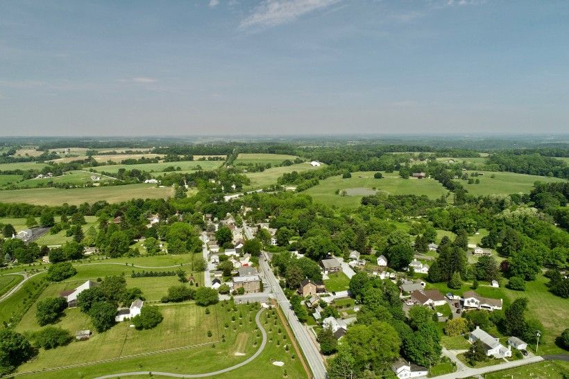
After nearly two years, the detour signs directing motorists away from the Twin Bridges over the Brandywine, just south of our campus in Chadds Ford, were finally removed last November. While the bridge re-opening is something to cheer from a convenience perspective alone, there are far more important aspects of the project to celebrate.
Click here to read more
Understanding Plant Hardiness Zones and Their Role in Garden Planning
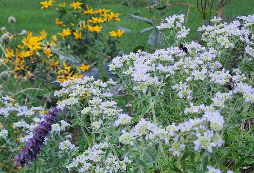
On our latest blog on the Brandywine's new Native Garden Hub website, we're highlighting plant hardiness zones—what they are, their significance, and how they can help you choose native plants that will thrive in your climate.
Click here to read more
Invasive Species Spotlight: Chinese Privet
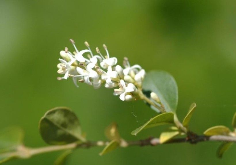
Originally introduced as ornamental plants for hedges and gardens in the 1800s, Chinese Privet (Ligustrum sinense Lour.) spread aggressively and now dominates disturbed areas such as fencerows, old fields, and forest edges. In our latest Invasive Species Spotlight, we outline how to identify and control Chinese Privet, plus offer a native alternative you can plant in your space instead.
Click here to read more
Recreating a Mansion

The Brandywine’s Penguin Court Preserve in Westmoreland County, PA was once home to a 67-room mansion situated in its fairytale landscape. Today, only a few remnants of the home can be found on the property. Now, with a new virtual reality tool, visitors to the property are able to envision what once was.
In 1939, construction of Alan and Sarah Scaife’s residence at Penguin Court was completed, beginning its life as a country home for the couple and their two children, Cordelia and Richard. The mansion was an impressive structure with separate bedroom suites for all four members of the Scaife family and a five-car attached garage with servant quarters above it.
After his mother passed away in 1965, Richard Scaife inherited the property, and because both he and his sister already had their own homes—and because neither Richard nor his mother particularly cared for the house—Richard had the structure torn down in the late 1960s. Today, all that remains are a few courtyard walls, patios, cobblestone driveways, and the changing rooms adjacent to the former inground pool.
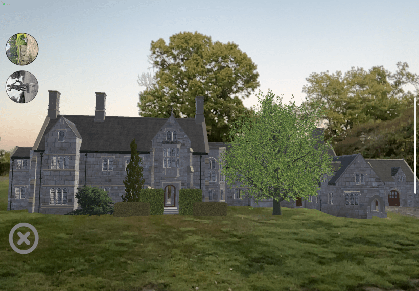
To visualize how the mansion sat on the grounds and to provide an interactive viewing opportunity for visitors to the property, Brandywine Conservancy contracted True Interactive of Murrysville, PA, to recreate the mansion’s exterior in Augmented Reality (AR). Now, after downloading the TrueAR app to their phone or tablet, Penguin Court guests can walk around the site with AR visuals that show the exterior of the house, to scale, from near and far.
“This is great way to marry nature and art, which Brandywine continually seeks to do,” said Penguin Court Program Manager, Melissa Reckner. “I have a hard time imagining how a four-story mansion fit within the space we see today, and so I’m excited for this new opportunity to breathe ‘life’ into that old house again.”
Community Waterside Gathering Recap
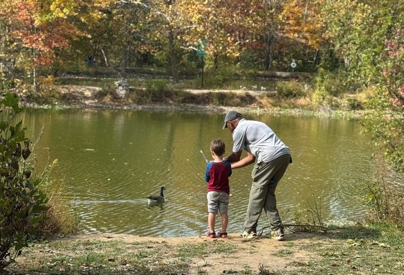
On the picture-perfect day of October 19, more than 50 adults and children of all ages gathered to explore, learn, and connect around one of the Kennett Square Area’s most vital resources: water. Anson B. Nixon Park, a treasured-local green space to recreate, became an outdoor classroom where attendees engaged in hands-on activities that made water quality approachable and meaningful.
Through interactive stations led by partners and volunteers, families learned how everyday choices affect ponds, streams, and other local waterways. Pond fishing and land-based dry casting activities accompanied with instruction introduced participants to the importance that water resources play in recreational opportunities. To build excitement and encourage continued learning beyond the event, participants could enter a raffle to win a fishing rod donated by Brandywine Conservancy.
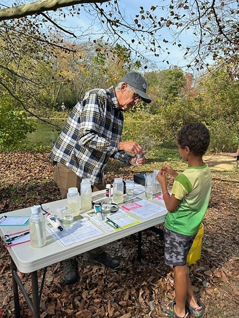
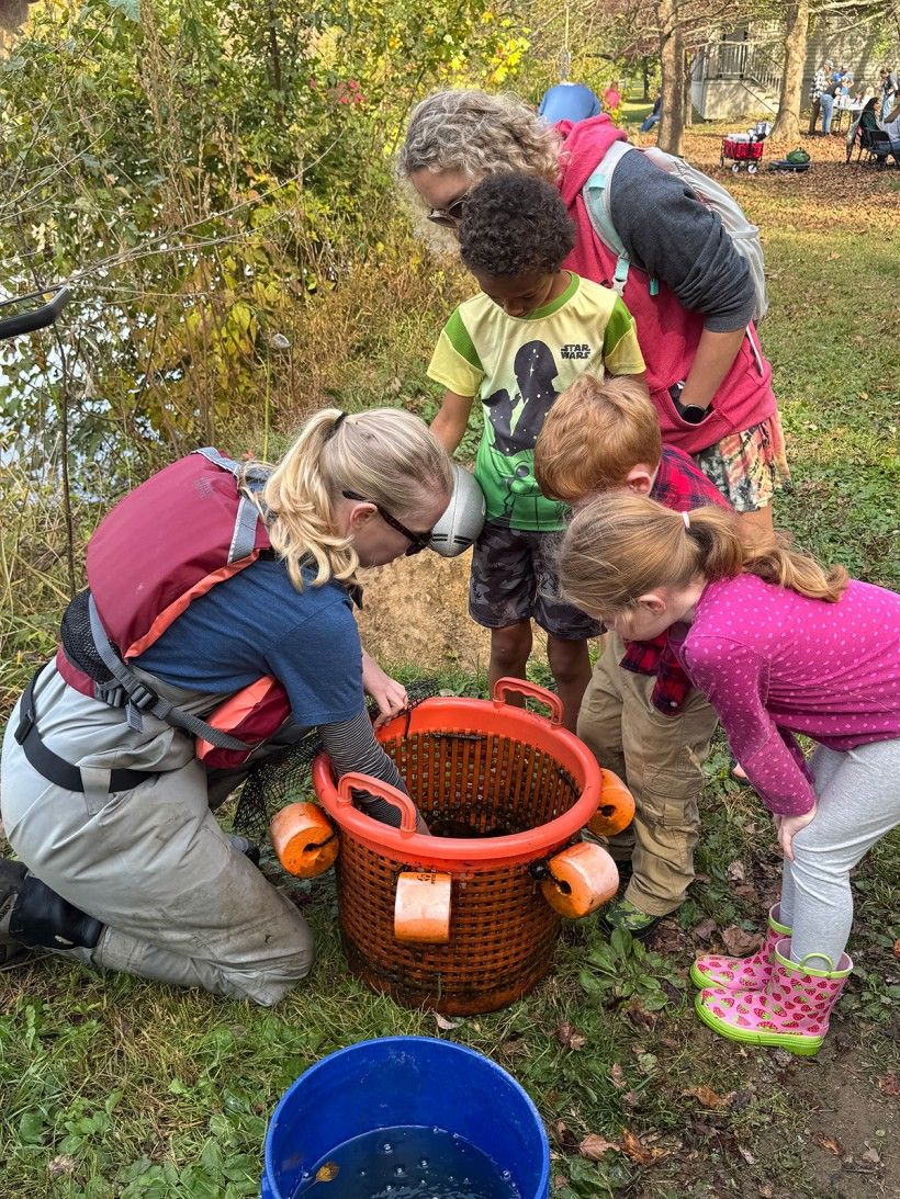
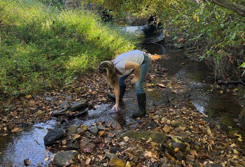
Many attendees became “environmental scientists,” testing pond water and discussing how runoff, pollution, and land use impact aquatic ecosystem health. Families explored nature through a bilingual storybook walk with sensory-friendly activities set among newly planted native trees, linking storytelling to living landscapes. Guided creekside walks highlighted the area’s environmental history and restoration efforts, while informational tables showcased freshwater mussels, watershed stewardship, and volunteer opportunities. Community feedback reflected growing awareness and a desire to protect local waters.
Thanks to dedicated partners Kennett Library, Partnership for the Delaware Estuary, Chester County Master Watershed Stewards, Clarke Green for leading activities; Brandywine Conservancy volunteers and funding through Pennsylvania Department of Environmental Protection, this free event fostered connection, curiosity, and stewardship—laying the groundwork to grow impact though through a similar program planned for spring 2026.
Financial and other support for the WATERSIDE TALES: EMPOWERING LOCAL COMMUNITIES THROUGH WATER QUALITY AWARENESS has been provided by the Department of Environmental Protection’s Environmental Education Grants Program.
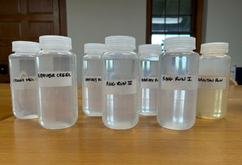
Brandywine Conservancy Participates in the Fall Salt Snapshot
Last fall, Brandywine Conservancy staff participated in the Fall Salt Snapshot, a community science initiative led by the Delaware County Office of Sustainability and supported by the Stroud Water Research Center. The Fall Salt Snapshot builds on winter salt monitoring by shifting the focus to baseflow conditions, times when streams are not influenced by recent rainfall, helping researchers and communities better understand how salt pollution persists in local waterways throughout the year.
As part of this effort, Conservancy employees collected water samples from seven stream sites across Chadds Ford and Pocopson Townships. Sampling during low-flow conditions allows for the capture of base level salt concentrations in streams, offering insight into long-term salt accumulation rather than short-term spikes associated with snow and ice events.
What we measured and what it tells us
At each site, samples were analyzed for chloride, salinity, and conductivity, three key indicators used to assess salt pollution in freshwater systems:
- Chloride is a major component of road salt and is often used as a direct measure of salt contamination. Elevated chloride levels can be harmful to aquatic life and, at high concentrations, may raise concerns for drinking water supplies.
- Salinity reflects the total amount of salt dissolved in the water. Freshwater streams naturally have low salinity, so increases can place stress on organisms adapted to these conditions.
Conductivity measures the ability of water to carry an electrical current and serves as a useful indicator of the total amount of dissolved ions, including salts, present in the stream. Higher conductivity values often signal ongoing salt influence.
Together, these measurements help paint a clearer picture of how salt moves through watersheds and remains in streams well beyond the winter season.
Why salt in streams matters
While road salt plays an important role in winter road safety, it does not break down once applied. Instead, salt dissolves and moves into nearby soils, groundwater, and surface waters. Over time, salt stored in the landscape slowly seeps back into streams, creating chronic exposure even during warm, dry months.
Persistent salt pollution can harm aquatic insects, amphibians, and fish, while disrupting the balance and function of stream ecosystems. Salt can also contribute to the corrosion of roads, bridges, and pipes and may complicate drinking water treatment, leading to increased costs for communities.


Looking beyond winter
The Fall Salt Snapshot complements the January Winter Salt Snapshot, which captures peak salt impacts during snow and ice conditions. Together, these efforts demonstrate that salt pollution is not limited to winter storms; it is a year-round issue affecting many urban and suburban streams. Conservancy staff plan to remain involved in monitoring efforts and anticipate participating in the Winter Salt Snapshot again in 2026, contributing to ongoing efforts to better understand seasonal trends and reduce salt impacts.
Data collected through the Fall Salt Snapshot will be added to a publicly accessible online salt map, supporting education, planning, and informed conversations about winter maintenance practices and long-term water quality protection. Brandywine Conservancy is proud to contribute local data to this collaborative effort and to support science-based approaches that protect streams, infrastructure, and drinking water across our region.
Everyday winter maintenance choices can make a real difference for local waterways. Simple steps, such as shoveling early, applying salt sparingly, and sweeping up leftover salt once ice melts, help keep excess salt out of storm drains and streams. Focusing salt use on only the areas that truly need it, considering alternatives for traction, and storing salt carefully to prevent spills are small actions that collectively add up to healthier waterways year-round.
For additional background on salt pollution in our waterways, see the following article written by John K. Jackson, Ph.D., Senior Research Scientist at Stroud Water Research Center: "Over-seasoned: Our Taste for Salt Is Killing Our Freshwater Ecosystems"
Recent Changes at Waterloo Mills Preserve
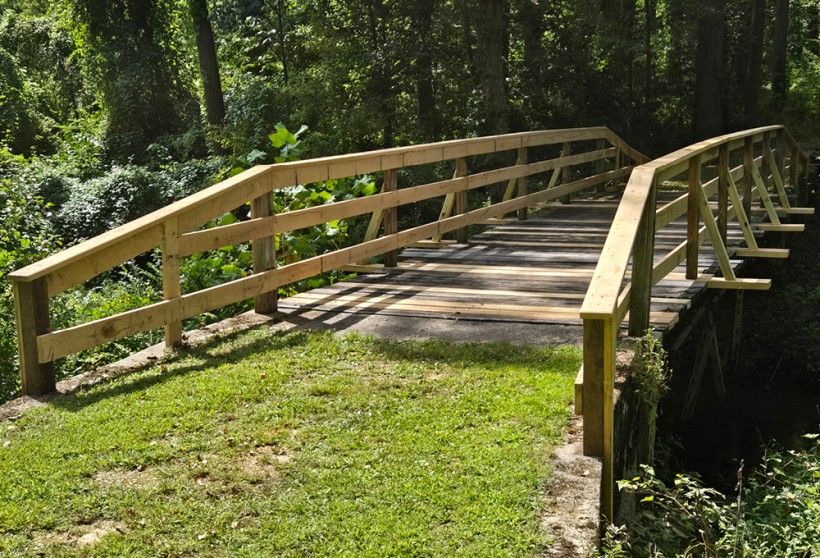
Change comes in many phases and scales. Seasons shift, species rise and fall, weather patterns fluctuate, equipment wears down, and our bodies evolve with time. At Waterloo Mills Preserve, change is a constant presence, shaping how our staff care for natural resources and reminding us that entropy is always at work. The Preserve’s ecosystem is both complex and delicate, requiring continual monitoring to ensure biodiversity and an enriching visitor experience.
Without added energy or maintenance, gradual change is inevitable. Ecosystems undergo natural succession—a slow transformation in species composition and habitat structure. Human structures are no different. Houses, kiosks, bridges, and buildings weather and deteriorate when exposed to the elements. Understanding that maintenance is essential to preserving order, our staff recently turned their attention to several aging structures throughout Waterloo Mills Preserve.
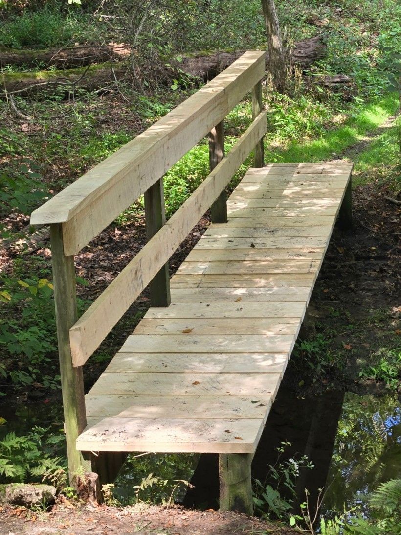
Thanks to a generous donation, our staff completed much-needed repairs on two bridges and a kiosk that had been used for more than 20 years. Darby Creek divides the property, and the two-mile loop trail includes three stream crossings. The older footbridges that spanned these crossings were built from pressure-treated lumber which, after decades of exposure, had become worn and dangerously slippery. To improve safety and enhance the visitor experience, staff replaced the handrails and deck boards with newly milled, rough-cut white oak. At 2.5 inches thick and naturally rot-resistant, the new boards provide durability, excellent traction, and a rustic aesthetic that blends seamlessly with the Preserve.
Leftover lumber was then used to repair a smaller footbridge spanning Ashbrook Run, a tributary feeding into Darby Creek. After construction, the white oak received a clear preservative to further protect it from the elements.
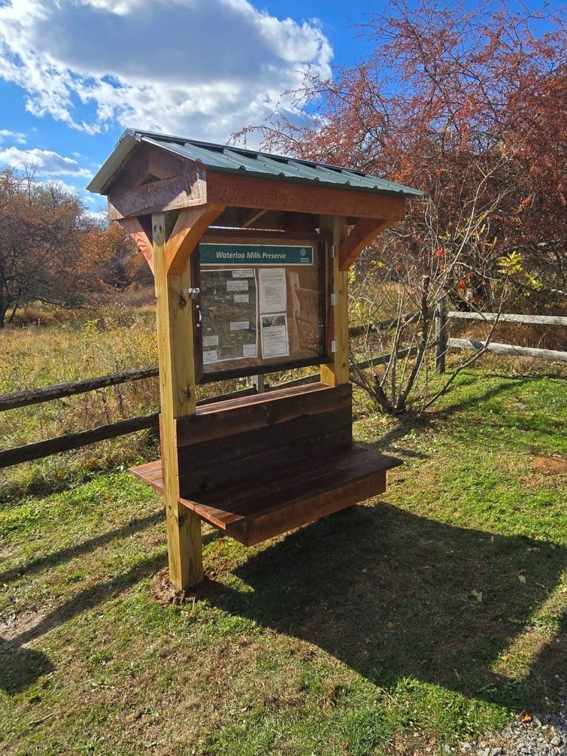
With additional wood still remaining, staff turned their focus to the parking-lot kiosk. They rebuilt the structure in the far corner of the lot, where it now features a large aerial photograph of the Preserve—highlighting boundaries, trails, and notable natural features. Perhaps the most exciting new addition is an integrated bench, which will offer a welcome resting spot for students, hikers, and all who explore the Preserve.
Much is happening at Waterloo Mills Preserve, and through the generosity of private donors, we can maintain the property to the high standard envisioned for its 170 acres. Biodiversity, education, research, and visitor experience remain our guiding priorities. We invite you to visit and see firsthand how we are working to embrace and guide the changes that shape this landscape.
New Municipal Assistance Program Projects
Brandywine's Municipal Assistance Program (MAP) staff kicked off the New Year by launching several new projects, all funded through the Chester County Vision Partnership Program. On January 6, Pennsbury Township held the kickoff meeting for their Comprehensive Plan update, with the Brandywine Conservancy serving as the project consultants. London Britain Township will also be working with the Brandywine Conservancy, in partnership with Recreation and Park Solutions to update their 1993 Open Space, Recreation and Environmental Resources Plan (OSRER). In addition, Londonderry and Pocopson Township will be working with the Conservancy to update their Comprehensive Plans, with project kickoffs anticipated in late winter or early spring.
MAP staff will also continue their work with East Nottingham Township on the development of an Official Map, with a focus on potential agricultural preservation and open space opportunities. This project was funded by the Chester County Vision Partnership Program Rolling Mini Grant.
Through funding from the William Penn Foundation, the Brandywine Conservancy is able to support the development of additional Official Maps to advance the Circuit Trails network.
For more information about Comprehensive Plans, Open Space, Recreation and Environmental Resources Plans and Official Maps, please visit the Municipal Resource Toolkits page on our website.
Remembering William L. "Doc" Elkins

William L. Elkins (August 2, 1932 – November 11, 2025) embodied a pioneering spirit. After a distinguished career as a research immunologist studying the human defense system at the University of Pennsylvania, William (“Bill” or “Doc”) Elkins shed the white coat for denim and returned to his first love—farming.
In 1985, Doc and his wife, Helen, purchased two King Ranch parcels totaling just over 100 acres and settled into ranching in western Chester County. They were among the original partners in Brandywine’s historic King Ranch Conservation Easement Project. In a 2008 local news article, Doc reflected, “I got wind that the lands were coming under easements. I had seen open space disappear around the Main Line. Helen and I have always believed in preserving the land.”
Over time, the Elkins acquired more than 300 acres to support their cattle operation, Buck Run Land and Cattle Co. Doc and Helen were often seen working side-by-side on the ranch and, like many farming couples, more than a few times finished each other’s thoughts and sentences. Doc believed deeply in sustainability, demonstrating that it is possible to raise high-quality, grass-fed beef while also protecting the natural resources that sustain the land. He brought his sharp and curious mind to continually innovating cattle farming. To learn more about Buck Run Land and Cattle Co.’s innovative practices, read our recent blog, "A Look at Landowner Stewardship."
Doc was many things to many people, and Brandywine joins the community in mourning his loss and celebrating the life and legacy of William L. “Doc” Elkins.
For more, read the complete obituary online at the Philadelphia Inquirer.
Meet the MAP Team

Brandywine's Municipal Assistance Program (MAP) team works alongside municipalities to tackle planning challenges, from land use and zoning to conservation and community visioning. In this spotlight series, meet the people who make that work happen and learn more about the skills and passions they bring to the team.

Quinty Birl
Quinty joined the MAP team as an Assistant Planner in December 2025. In his new role, he supports lead staff on municipal planning and technical assistance projects. He recently graduated from the Tyler School of Art and Architecture at Temple University with a B.S. in Community Development. Prior to joining the Brandywine Conservancy, Quinty worked in Youth Development at the YMCA, which was preceded by an internship with the Chester County Planning Commission, as well as serving as a Swim Instructor for West Chester University’s Swim Lessons program. Quinty is also active in his hometown of West Chester, where he serves on the Borough’s Planning Commission.

Beth Burns
A Lead Planner with the MAP Team, Beth brings a historic perspective to the planning work at hand. While she works on a variety of planning projects with municipalities such as Comprehensive Plan updates, Beth’s background in Historic Preservation Planning makes her well suited to being the resident historian of the bunch. She recently finished a Heritage Interpretation Plan for the Mason-Dixon/Arc Corner Region and is beginning Comprehensive Plan Updates for Pennsbury as well as Pocopson Townships. With her knowledge of historic architecture, Beth also works with the Land Stewardship team on occasion, monitoring the 25 facade easements held by the Conservancy.

Olivia "Liv" Falcone
Liv is a Lead Planner with Brandywine’s MAP team, providing technical planning support for comprehensive plans, open space plans, official maps, green stormwater initiatives, and other municipal projects across Chester and Delaware counties. She also contributes to reports, project metrics, and project-related analyses. Liv’s experience includes ordinance amendments in Pennsbury Township, Upper Uwchlan’s Comprehensive Plan Update, East Nottingham’s Official Map and Ordinance for East Nottingham Township, and multiple Brandywine Creek Greenway Mini Grant projects. Liv joined the Brandywine Conservancy in January 2022. She attended Clark University in Worcester, Massachusetts where she earned dual Bachelor of Arts degrees in Geography and Art History (2020), followed by a Master of Arts in Community Development and Planning (2021).

Sarah Sharp
As the Assistant Manager of the Municipal Assistance Program, Sarah works closely with municipalities to develop partnerships on planning projects and oversees ongoing work within the MAP department. She leads a variety of municipal planning efforts, including Comprehensive Plans, Open Space Plans, and GIS projects and reports. Sarah has been with the Conservancy for more than seven years, starting out as a Municipal Assistance intern. She currently serves on the Chester County Environmental & Energy Advisory Board and her local Open Space Committee in her hometown of Chadds Ford Township. Outside of work, Sarah enjoys spending time with her husband, their son (born in August 2025), and their two cats.

Rob Daniels
As the Assistant Director of Community Services, one of Rob's roles is to support staff and guide projects within our Municipal Assistance Program. For over a decade, prior to his role as Assistant Director, Rob was a planner in our MAP department, so he brings a wealth of experience and knowledge working with our municipal partners on a variety of planning projects. During his time as a planner, Rob led many municipal Comprehensive Plans and Open Space Plans. Rob is also the author of the Brandywine Creek Greenway Water Trail Feasibility Study and the Bennetts Run Watershed Conservation Plan, and serves as a co-lead for our annual Bike the Brandywine event. Rob has also served on several Chester County Trail Plan Committees, and in his spare time is the Vice-Chair of the East Marlborough Environmental Advisory Council and the Chair of the Board for The Friends of Unionville.
Featured Photo: Canada Geese on Campus

Winter weather is better together! These Canada geese (Branta canadensis) were among those spotted visiting our campus trails earlier this winter.
📸: Brendan Delaney